Stage 2 of the Tour du Mont Blanc starts in Les Houches in Chamonix Valley and ends in Les Contamines-Montjoie in Val Montjoie. Note: for many TMB hikers, this will be stage 1.
There are a few decisions to make today.
You can follow the main TMB route to Les Contamines via Refuge du Fioux, Bionnassay, and Le Champel.
Alternatively, you can opt for the TMB Variant via Col de Tricot (2120 meters), Refuge de Miage, and Refuge du Truc.
Most hikers who choose the TMB Col de Tricot variant will also take the Bellevue cable car from Les Houches up to the Bellevue Plateau (1800 m). The cable car ascent shaves off 803 meters of elevation gain (6.9 km / 2 hours). It’s worth it!
This Tour du Mont Blanc stage has the potential to be boring and grueling. However, if you opt for the Bellevue cable car combined with the Col de Tricot variant, it’ll be far more enjoyable.

- Starting Point: Bellevue cableway, Les Houches, France
- Ending Point: Les Contamines-Montjoie, France
- Distance: 12.1 km point-to-point
- Time Needed: 5 – 5:30 hours
- Elevation Gain: 702 meters
- Elevation Loss: 1322 meters
- Difficulty: Moderate
- Minimum Elevation: 1148 meters
- Maximum Elevation: 2119 meters
- Where to Stay in Les Contamines-Montjoie: Chalet-hôtel Gai Soleil (midrange), or Chalet-Hôtel La Chemenaz (luxury)
- Self-Guided Hiking Tour: 10 Day Standard Tour du Mont Blanc (what we booked) / 10 Day Comfort Tour du Mont Blanc (private rooms only)
Les Houches to Les Contamines-Montjoie Trail Map
Where to Start the Col de Tricot Variant
Bellevue Cable Car Valley Station
From your accommodation in Les Houches, you can either walk or take a regional bus to the valley station of Télécabine de Bellevue.
Valley Station Address | 77 Pl. de la Fruitière, 74310 Les Houches, France | Google Maps
Adult Ticket Prices | 17 EUR one-way
Operating Times | Chamonix.com
Les Houches – Col de Tricot – Les Contamines-Montjoie Trail Description
Bellevue Mountain Station to Col de Tricot (2:15 hours)
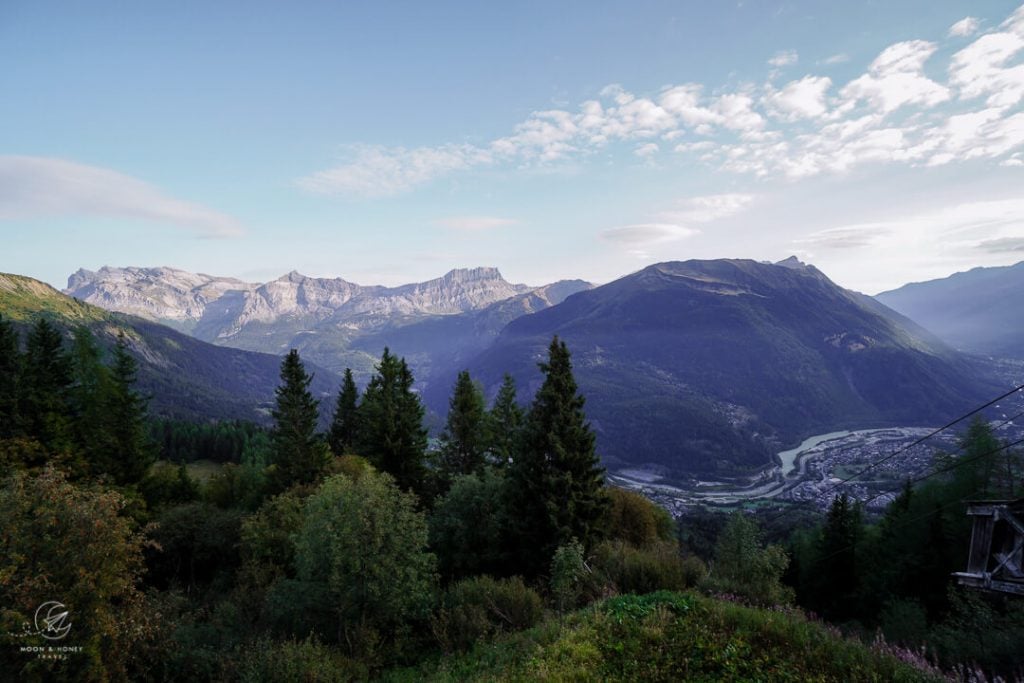
Follow signs to Col de Tricot (2:15 hrs).
Cross the train tracks of the Tramway du Mont Blanc and descend the narrow path through a patch of woods.
Shortly thereafter, turn left on the main trail towards Mont Blanc and Glacier de Bionnassay.
The TMB variant leads across a forested slope of birch and spruce above the Bionnassay valley.
Narrow rocky passages are secured with cables.
At the L’Are trail junction (1760 meters), continue towards Col de Tricot (1:45 hours) and Chalets de Miage (3:05 hours).
A gate marks the entrance to the Alpage de L’Are alpine pasture. The sign (French only) informs hikers that they are entering an alpine pasture, where Hérens cattle graze during the summer months. The owners request that you don’t pet the cattle and to keep dogs on leash while crossing the pasture. They also remind hikers to close pasture gates properly after passing through.
The trail leads across wide open meadows to the Plat de l’Arve (1775) trail junction. Turn right.
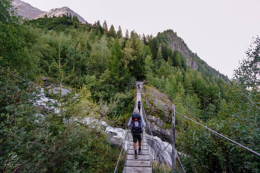
Soon, the path descends steep, slippery switchbacks to a suspension bridge, which spans the tumbling Bionnassay stream.
Cross the bridge and ascend to a verdant basin, where the path eases for a while, with sweeping views of the Bionnassay glacier.

The dirt path gently rises up to the broad saddle of Col de Tricot (2120 meters). Though the gradient is very moderate, the ascent takes longer than you’d expect.
Col de Tricot to Chalets du Miage / Refuge de Miage (1:20 hours)
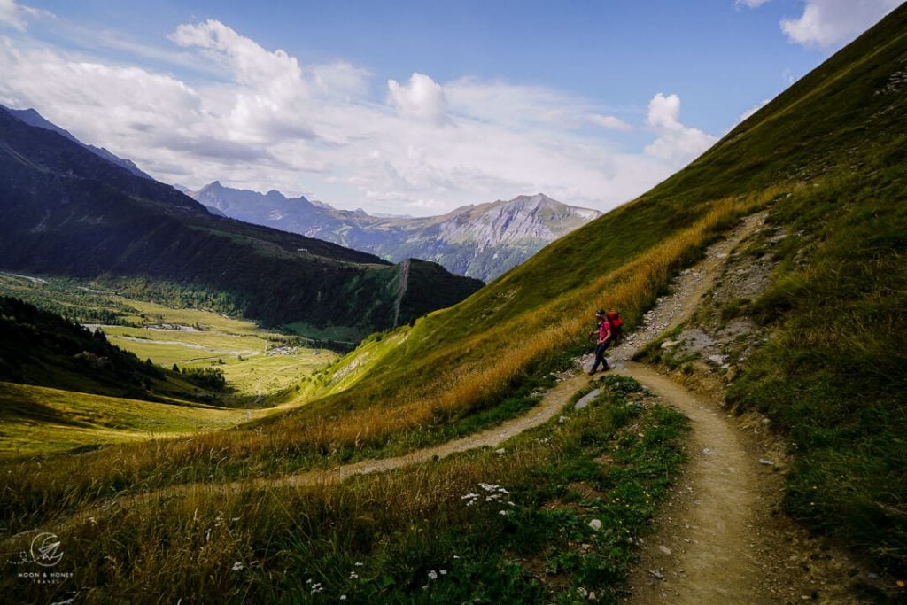
Col de Tricot (2120 meters) marks the highest point along this stage of the TMB. From the saddle, the Chalets du Miage are clustered together in a wide-open clearing at the base of Mont Truc.
The TMB trail follows a serpentine path all the way down to the Miage pastures.
When you reach level ground, cross the alpine pasture and walk to Refuge de Miage.
Lunch at Refuge de Miage

Refuge de Miage (1550 meters) is an idyllic setting for an al fresco lunch. The service is swift and friendly and the food is fresh and delicious.
Open | June – September
Payment | Cash Only
Accommodation | Dorms and Private Rooms
Toilets | There’s no toilet in Refuge de Miage for day visitors. The closest toilet is located near the Miage stream about 50 meters from the refuge.
Refuge de Miage to Auberge du Truc (35 minutes)
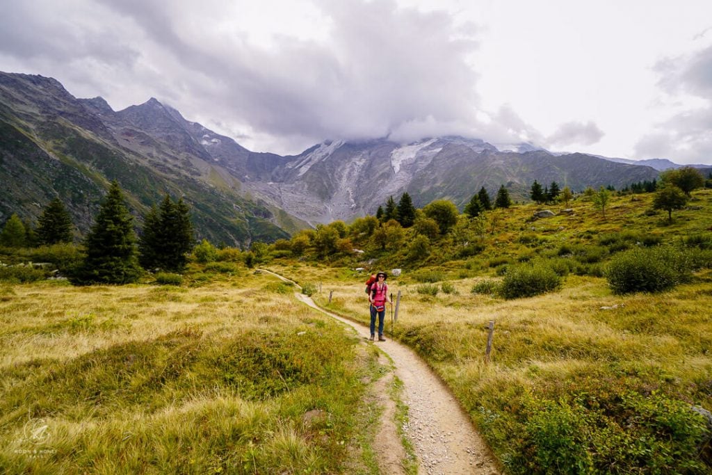
Follow signs to Chalets du Truc (35 minutes), La Frasse (1:35 hours), an Les Contamines-Montjoie (1:50 hours).
The TMB continues along a gravel road across the Miage pastures.
The main focal point is Dômes de Miage, a line of glaciated mountains which form part of the Mont Blanc massif.
After crossing a stream, the TMB branches off the gravel road to the left. The path steeply climbs 180 meters up a grassy hill followed by a patch of forest.
After 20-25 minutes, the trail crests the Truc plateau, which serves as another alpine pasture for grazing cattle.

Follow the level dirt trail to the Chalets du Truc. The happily-situated Auberge du Truc is another place to eat, or even overnight. The refuge is open from mid-June until mid-September. The views of the Dômes de Miage are even more impressive from here.
Refuge du Truc to La Frasse (1 hour)
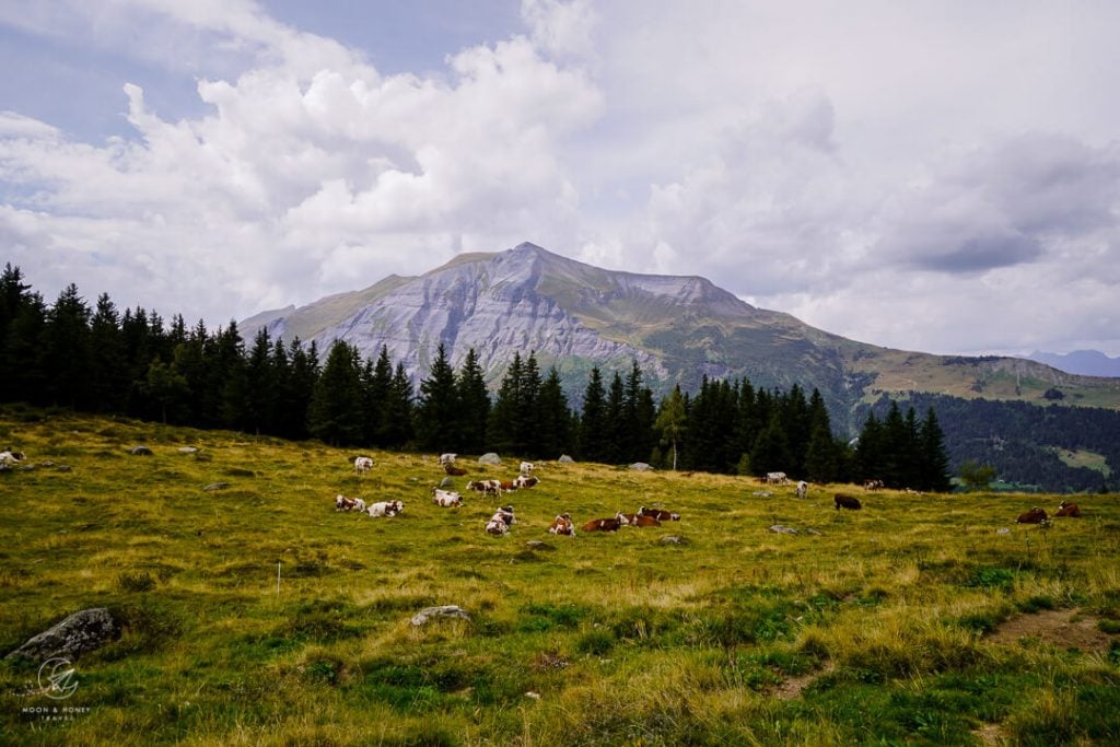
Continue along the gravel road between fenced-off grazing areas. The mountain straight ahead is Mont Joly.
The Tour du Mont Blanc follows forest roads and forest trails down to La Frasse, a neighborhood/hamlet above Les Contamines.
At the Les Granges de la Frasse (1350 meters) trail junction, follow signs to Les Contamines (20 minutes).
La Frasse to Les Contamines-Montjoie (20 minutes)
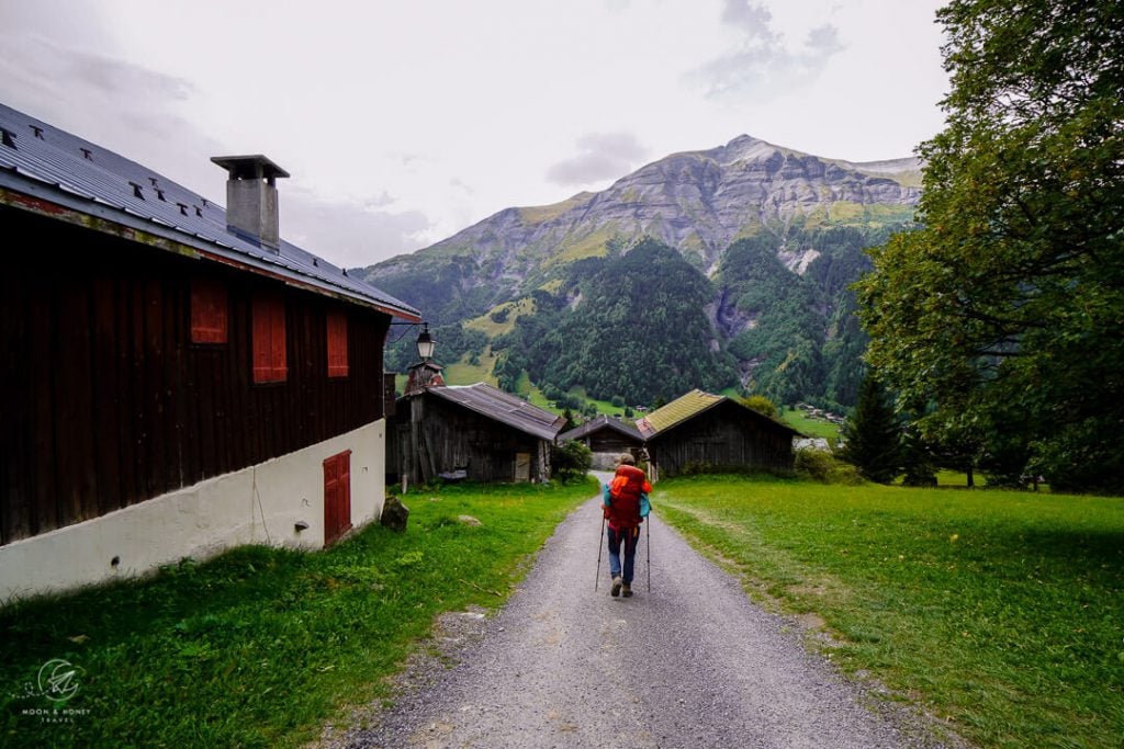
The final stretch leads between farm buildings of La Frasse down to Les Contamines.
We followed the “Chemin du Ptou” pedestrian path to Église de la Sainte-Trinité church, which is located in the heart of Les Contamines.
Where to Stay in Les Contamines
Budget | Gîte les mélèzes is an impeccably-run accommodation with only a few shared rooms. We had a very memorable stay in this intimate Gîte, because of the charming hosts, the excellent homemade dinner, and the overall atmosphere. Toilets and showers are communal.
Midrange | Chalet-hôtel Gai Soleil is a top-rated chalet hotel with cozy private rooms, a lovely garden, and kind and attentive staff. Stay here for the excellent meals (breakfast and dinner).
Luxury | Chalet-Hôtel La Chemenaz is a chalet hotel with an on-site restaurant, bar, and swimming pool. Though upgrades are needed (bathrooms, spa, etc…), this accommodation offers more comfort than the average TMB accommodation.
Look for accommodation in Les Contamines-Montjoie.
Tour du Mont Blanc Essential Info
Read our Tour du Mont Blanc Hiking Guide to start planning your trek.
Quick Facts
- Official TMB Length: 170 km (105 miles)
- Days Needed: 10-11 days
- Which Direction to Hike: Counterclockwise
- Where to Start the TMB: Chamonix, Vallée de l’Arve, France
- Closest Airport to Chamonix: Geneva Airport, Switzerland
- When to Hike the TMB: July – early September
- When to Book the TMB: January – February
- TMB Difficulty: Moderate
- Recommended Self-Guided Tours: 10 Day Standard Tour du Mont Blanc (private and shared rooms), 10 Day Comfort Tour du Mont Blanc (private rooms only), 7 Day Tour du Mont Blanc (shortened route with transit shortcuts), 15 Day Tour du Mont Blanc (leisurely-paced route).
TMB Planning Resources
- TMB Hiking Guidebook: Cicerone: Trekking the Tour of Mont Blanc guidebook
- TMB Trail Maps: L’Escursionista Tour du Mont Blanc TMB or IGN Tour du Mont Blanc Map
Tour du Mont Blanc Route Itinerary
The Tour du Mont Blanc (TMB) is a captivating multi-day hike that circuits the Mont Blanc massif in usually 10-11 days, passing through France, Italy and Switzerland. Here’s our personal TMB itinerary.
- Stage 1: Chamonix – Le Brévent – Les Houches
- Stage 2: Les Houches – Les Contamines-Montjoie (Col de Tricot Variant)
- Stage 3: Les Contamines – Refuge de la Croix du Bonhomme
- Stage 4: Refuge de la Croix du Bonhomme – Cabane du Combal (Col des Fours Variant)
- Stage 5: Cabane du Combal – Courmayeur – Rifugio Bertone
- Stage 6: Rifugio Bertone – Grand Col Ferret – Alpage de La Peule
- Stage 7: Alpage de La Peule – Ferret – La Fouly – Champex-Lac
- Stage 8: Champex-Lac – Trient (Fenêtre d’Arpette Variant)
- Stage 9: Trient – Col de Balme – Aiguillette des Posettes – Tré le Champ
- Stage 10: Tré le Champ – Lac Blanc – La Flégère – Chamonix
More Guides about Hiking in Europe
European Alps:
- The Alps in Summer: 10 Things You Need to Know Before Visiting
- Hiking in the European Alps
- Italian Alps Hiking Destinations
- Austrian Alps Hiking Destinations
- Slovenia Alps Hiking Guide
Multi-Day Hikes in Europe:
Hut to Hut Hiking:


