The Liechtenstein Panorama Trail (Route 66) ends on the highest of high notes.
Stage 4 begins with a sunrise, or early morning ascent to Naafkopf peak (2571), where the borders of Liechtenstein, Austria, and Switzerland meet.
After summiting Naafkopf, return to Pfälzerhütte for breakfast and then continue hiking north along the ridge to Augstenberg peak (2358 m).
Route 66 traces the celebrated Fürstin-Gina-Weg to Sareiserjoch and then gently descends to the village of Malbun.
This spellbinding hike is a popular day hike as well, so we recommend getting an early start.
More Stages:
- Liechtenstein Panorama Trail Stage 1
- Liechtenstein Panorama Trail Stage 2
- Liechtenstein Panorama Trail Stage 3
- Liechtenstein Panorama Trail Stage 4

- Starting Point: Pfälzerhütte
- Ending Point: Malbun
- Distance: 10.5 km point-to-point
- Time Needed: 4:45 hours
- Elevation Gain: 718 meters
- Elevation Loss: 1216 meters
- Difficulty: Moderate
- Minimum Elevation: 1599 meters
- Maximum Elevation: 2571 meters
- Route: Pfälzerhütte – Naafkopf – Pfälzerhütte – Augstenberg – Sareiserjoch – Malbun
- Lunch Option: We ate lunch at Schlucher-Treff (Google Maps) in Malbun.
- Where to Stay in Malbun: Hotel Turna Malbun, Hotel & Falknerei Galina, or Vögeli Alpenhotel Malbun.
Liechtenstein Panorama Trail Map
Stage 4 is highlighted in green.
Pfälzerhütte – Naafkopf – Augstenberg – Malbun Trail Description
Pfälzerhütte – Naafkopf – Pfälzerhütte (2 hours out-and-back)
On our WK375 Freytag & Berndt map, the trail to Naafkopf is dotted (as opposed to dashed), which signifies that it’s very difficult. That’s misleading, because the ascent to Naafkopf is moderate. The path is well-maintained, obvious, and easy-to-follow, so it’s ideal for a sunrise mission.
We left most of our things in the hut and set out in the wee hours of the morning.
From Pfälzerhütte, head south, passing the annex building Adler (winter room).
After 15 minutes, you’ll arrive at a signed trail junction. Bear right, ignoring the trail leading to Schesaplanahütte.
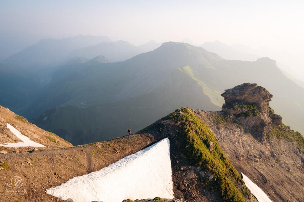
The trail traverses the east slope of the ridge and then steeply twists up.
When you crest the ridge, make a sharp left and continue ascending to the peak.
The 2571-meter-high summit, marked with a cross, overlooks the Schesaplana massif, the Grauspitz peaks, and many other pinnacles.

During our hike, the visibility was extremely hazy due to smoke particles from the wildfires in Canada (unbelievable, but true: meteoschweiz).
Our photos don’t depict what a normal sunrise looks like atop the Naafkopf triple border.
The return route follows the same trail.
Breakfast in Pfälzerhütte

Feeling very accomplished, we returned to the hut for breakfast. Breakfast consists of homemade bread, high-quality cold cuts and cheeses, butter, jam, strong coffee, and tea.
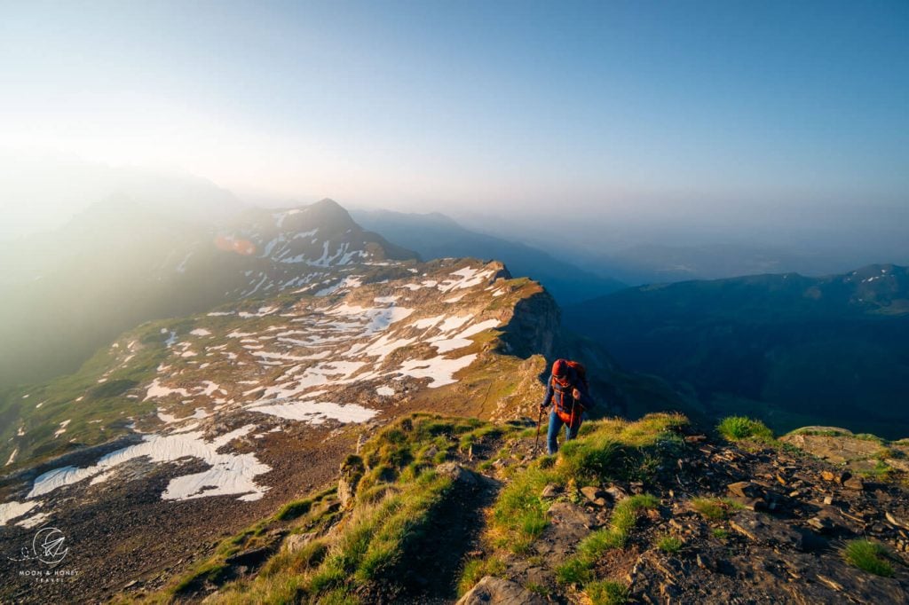
Pfälzerhütte to Augstenberg Peak (50 minutes)

Follow the narrow trail along the grassy ridge leading north. All exposed sections are secured with cables and railings.
As you gain elevation, look south. The views of Naafkopf and the surrounding ridges and peaks are staggeringly beautiful.

The Fürstin-Gina-Weg cuts across grass and scree slopes, avoiding the main crest, which develops into a rocky, jagged summit.
When the path returns to the ridge, the ascent continues up a field of boulders with no difficulty.

The way is marked with white-red-white trail markers.
It’s an easy jaunt across the wide grassy ridge to the tiptop of cross-bearing Augstenberg (2358 m).
Augstenberg Peak to Sareiserjoch (50 minutes)

With views of Malbun and the Gamperdonatal valley, the Liechtenstein Panorama Trail descends, following the rocky ridge.
The trail continues towards Spitz peak, either directly on, or just below the main crest.

A turnstile signals the beginning of a pasture area.
There are countless avalanche barriers on the left side.
After 50 minutes, you’ll arrive at the Sareiserjoch saddle (2000 m), which links Nenzinger Himmel, a village in Vorarlberg, Austria, with Malbun.
Sareiserjoch to Malbun (45 minutes)

Continue straight to Malbun.
After about 5 minutes, you’ll arrive at another intersection. Turn left to Malbun and zigzag down the grassy, dwarf-pine-carpeted mountainside.
Join the wide gravel road and effortlessly descend into Malbun.
Shortly before reaching the village, you’ll pass the Friedenskapelle chapel.
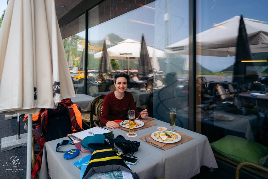
We both ordered a satiating and mouthwatering Rösti at Schlucher-Treff, next to the Malbun tourist office.

Depart Malbun, or Stay in Malbun

Stage 4 of the Liechtenstein Panorama Trail – Route 66 isn’t long. Depending on the season (and the time of sunrise), you’ll likely complete this stage between noon and 2 pm.
You can depart Malbun today. There’s a direct bus that connects Malbun with Vaduz.
We decided to stay in Hotel Turna Malbun – the same excellent hotel we stayed in between stage 2 and stage 3. It was very relaxing.
The next day we felt sufficiently rested and ready for the return trip back to Vienna: bus to Vaduz, bus to Feldkirch, and train to Vienna.
Keep Reading about the Liechtenstein Panorama Trail
- Liechtenstein Panorama Trail Hiking Guide
- Liechtenstein Panorama Trail Stage 1
- Liechtenstein Panorama Trail Stage 2
- Liechtenstein Panorama Trail Stage 3
- Liechtenstein Panorama Trail Stage 4

If you thought this post was helpful, follow us on Instagram @moonhoneytravelers
Liechtenstein Hiking Essentials
Read our Liechtenstein Panorama Trail hiking guide for a complete overview of this outstanding trek in the Rätikon Alps.
Hut Hiking Packing List
Read our personal hut-to-hut hiking packing list.
Mountain Hut Essentials
Pack these mountain hut essentials in addition to sufficient cash, your alpine club membership card, Kindle, sun protection, cosmetics, and ear plugs.
- Sleeping Bag Liner: Sea to Summit Silk-Cotton Blend Travel and Sleeping Bag Liner (what we use). Other options: Cocoon Cotton TravelSheet and Yen’s Mulberry Silk Sleeping Bag Liner
- Waterproof Slippers: Crocs. I also like bringing these Crocs Women’s Swiftwater Sandals, because they’re more versatile.
- Headlamp: Black Diamond Equipment Spot 350 Headlamp
- Plug Type J Adaptor: Liechtenstein uses plug type J (three round pins), like Switzerland. USA – Plug J outlet adaptor. We used this :EU to Plug J outlet Adaptor.
Hiking Gear
- Hut-to-Hut Hiking Backpack: Osprey Kyte 36 Women’s Hiking Backpack / Osprey Kestrel 48 Men’s Hiking Backpack
- Grade B/C high-cut hiking boots: Meindl Schuhe Island Lady (Kati’s Boots), Women’s Hanwag Tatra II GTX (Sabrina’s Boots), Men’s Hanwag Tatra II GTX (men’s equivalent)
- CAT 4 Sunglasses: Julbo Shield Mountain Sunglasses
- Hiking Poles: Black Diamond Trail Trekking Poles
- Reusable Water Bottle: Ion Leakproof 32 oz Water Bottle
Outdoor Photography Gear
- Camera Body: Sony Alpha a6400
- Mid-range Zoom Lens: Tamron 17-70mm 2.8 Di III-A VC RXD
- Wide angle Zoom Lens: Sony – E 10-18mm F4 OSS Wide-angle Zoom Lens
- Backpack Camera Clip: Peak Design Camera Clip
Learn more about the Alps
Essential Tips:
- The Alps in Summer: 10 Things You Need to Know Before Visiting
- Hiking in the Alps: Essential Tips
- Best Hikes in the Alps
Hut-to-Hut Hiking in the Alps:
