The Sciliar-Catinaccio Nature Park (Parco Naturale Sciliar-Catinaccio in Italian, Naturpark Schlern-Rosengarten in German) is the oldest nature park in South Tyrol, Italy, and also a UNESCO World Heritage Site (Dolomites System 7).
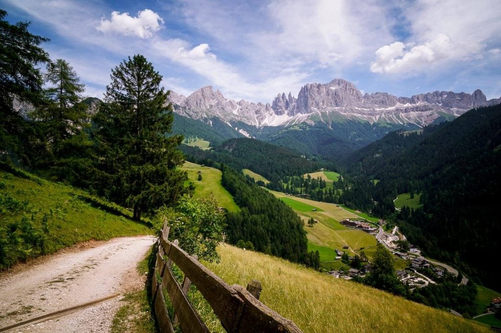
The protected area covers an area of over 7,291 hectares and encompasses the Sciliar/Schlern massif, Cima Santner/Santnerspitze and Cima Euringer/Euringerspitze towers, the South Tyrolean part of the Catinaccio/Rosengarten massif, and part of the Alpe di Siusi plateau.
You can access this Dolomites nature park from Alpe di Siusi, Seis, Castelrotto, Fiè allo Sciliar, Tires al Catinaccio, San Cipriano, and Val d’Ega.
In this brief guide to visiting Sciliar-Catinaccio Nature Park, we’re highlighting the main attractions and hidden gems in the park you shouldn’t miss.

- Italian Province: South Tyrol, Italian Dolomites
- When to Visit: June – October
- Where to Stay: Alpe di Siusi, Tires Valley, Carezza
- Entrance Fee: The park is free to visit
- Permits: None needed
Sciliar-Catinaccio Nature Park Map
Sciliar-Catinaccio Top Attractions
Rifugio Alpe di Tires / Tierser Alpl Schutzhaus

The red-roofed Rifugio Alpe di Tires is an outstanding mountain hut located on the Passo Alpe di Tires/Tierser Alpljoch saddle, between the Sciliar/Schlern Group and the Rosengarten/Catinaccio Group.
Though the hut dates back to the 1960s, it was lovingly renovated a few years ago. The interior is modern, the rooms are spotless, and the South Tyrolean cuisine is phenomenal.
It’s the perfect base for tackling the Sentiero attrezzato/Maximiliansteig and Laurenzi/Laurenzisteig via ferrata routes.
You can hike to Rifugio Alpe di Tires from Compaccio via the Forcella Denti di Terrarossa/Rosszahnscharte (2:30 – 3 hours one-way), or via Rifugio Bolzano (5 hours).
You can also approach the hut from the east along the Friedrich-August-Weg from Rifugio Sass Piatto/Plattkofel Hütte and Sella Pass.
The most thrilling approach is from the south. Starting in Val d’Ega/Eggental, you can hike to Rifugio Alpe di Tires via the Vajolet Towers, Passo Principe/Grasleitenpass and Passo Molignon/Pas de Molignon. We outlined this itinerary in our 3 day Catinaccio-Rosengarten Trek.
Vajolet Towers

The Vajolet Towers (Torri del Vajolet in Italian) are a cluster of six pinnacles in the Catinaccio/Rosengarten Group. This unique formation is both striking and bizarre.
They straddle the border between Trentino and South Tyrol, and thus can be approached from Val di Fassa, Val d’Ega, Valle di Ciamin.
The best way to approach the Vajolet Towers is via the Santner via ferrata/klettersteig. The via ferrata starts close to Rifugio A. Fronza alle Coronelle/Kölnerhütte (2337 m) and delivers you to Rifugio Passo Santner/Santnerpasshütte (2734 m). From the pass, you’ll descend to Rifugio Re Alberto/Gartlhütte (2621) at the base of the towers.
This was the first via ferrata we did in the Dolomites, and I was nervous as hell. But, it was very manageable!! We wrote about the Santner via ferrata in this 3 day Catinaccio-Rosengarten Trek.
To complete the circuit back to Rifugio A. Fronza alle Coronelle/Kölnerhütte, follow trail 542 to Rifugio Vajolet and then continue on Trail 541 to Forcella di Davoi, followed by 550 to Passo delle Coronelle/Tschager Joch. From the pass, it’s a quick, steep descent to the hut.
Essential Via Ferrata Gear
Climbing Gloves: Black diamond half finger gloves
Women’s Climbing Helmet: Black diamond women’s climbing helmet
Men’s Climbing Helmet: Black diamond men’s climbing helmet
Climbing Harness: PETZL Corax Climbing Harness
Lanyard with Carabiners: PETZL Scorpio Lanyard with Carabiners and Energy Absorber
Sciliar / Schlern Plateau

Sciliar/Schlern (2564 m) is an impressive mountain rising vertically above Valle d’Isarco/Eisacktal valley. It’s considered the symbol of the South Tyrol (Südtirol/Alto Adige) region.
The mountain is defined by a long stretched plateau which narrows into a single ridge formed by the towers of Denti di Terrarossa/Roßzähne (“horse teeth”).
Rifugio Bolzano/Schlernhaus (2456 m), fondly called the “Castle in the Dolomites,” sits atop the Sciliar/Schlern plateau. From its lofty position, visitors can relish the views of the Catinaccio peaks, the Sassolungo/Langkofel group, and the Latemar spires.
You can hike to Rifugio Bolzano and the Sciliar Plateau from Alpe di Siusi. Starting at Compatsch/Compaccio, it takes about 2:45 hours to reach the hut. Learn more about this hike here: Alpe di Siusi – Rifugio Bolzano – Alpe di Tires hike.
Plafötschalm

Plafötschalm (1570 m) is a welcoming alpine pasture hut in the municipality of Tiers, only accessible by foot.
This South Tyrolean Almhütte occupies a peaceful clearing, secretly tucked away from the village of San Cipriano/St. Zyprian.
During the summer season (May – October), visitors can enjoy a homemade meal here along with spectacular views of the mighty Catinaccio/Rosengarten and Latemar mountains.
Most alpine pasture huts welcome day visitors only, but Plafötschalm also accommodates overnight guests. It’s similar to a refuge, but far more comfortable and intimate. There are only a few rooms and each room has its own ensuite bathroom with hot water.
Plafötschalm is a lovely retreat for those who want to slow down, enjoy wonderful mountain views, and even read a book. All guests receive half board (breakfast and dinner) during their stay.
During our stay, we hiked the easy walking path from Plafötschalm to Albergo Frommeralm via Hanigerschwaige and Almhütte Baita Messnerjoch. From Albergo Frommeralm, we took a bus back to the Plafötsch Bus Stop, and then hiked up the forest road to the Alm.
Overnight guests of Plafötschalm receive the Südtirol Alto Adige Guest Pass (Mobilcard) free of charge.
Laghetto di Wuhn/Wuhnleger Löschteich

Laghetto di Wuhn/Wuhnleger Löschteich is a small pond on the Malga Wuhn/Wuhnleger alpine pasture, located at an elevation of 1402 meters, in Sciliar-Catinaccio Nature Park.
This is an appealing location for sunset photography, because the pond forms the foreground for the Catinaccio massif skyline.
You can hike up to the Wuhnleger pond from the Lavina Bianca/Weisslahnbad parking lot, close to the village of San Cipriano/St. Zyprian in Tiers Valley.
Tschafonhütte and Völseggspitze
The hike to Laghetto di Wuhn/Wuhnleger Löschteich is best combined with a visit to Tschafonhütte. This mountain hut is situated at an elevation of 1737 m and faces the Catinaccio/Rosengarten massif.
On summer days, locals and tourists sunbathe on the large meadow below the hut.
If you visit the hut, take a quick detour (20 minutes) to Punta Völsegger/Völseggspitze peak for sweeping views of Eisacktal valley, high plateau of Fiè allo Sciliar, and Tiers Valley.
Visiting Schlern-Rosengarten Nature Park Responsibly
The park was established in 1974 and became a listed UNESCO World Heritage Site in 2009. Please adhere to the following rules when visiting:
No motor vehicles are allowed within the park.
Wild camping is prohibited in the park.
Always stay on marked trails and paths. This helps prevent damage to the meadows and alpine pastures.
Do not pick flowers.
Respect the habitat of animals. Do not make any unnecessary noise.
Do not light fires.
Do not litter. Please take your garbage with you and dispose of it responsibly.
Do not touch, or approach grazing animals.

Dolomites Trip Planning Essentials
Use our Dolomites Travel Guide to plan an unforgettable trip to Northern Italy.
When to Hike in the Dolomites
The best time to hike in the Dolomites is between mid-June and mid-September. If the weather is stable, the hiking season can extend until late October.
How to Get to the Dolomites
Read How to Get to the Dolomites to find out how to travel to the Dolomites from the closest airports, train stations, and bus terminals.
If you’re traveling without a car, also check out How to Visit the Dolomites Without a Car.
Car Rental
The easiest way to travel between hiking destinations in the Italian Dolomites is with your own car. Check out our itineraries for trip inspiration:
We recommend using the Discovercars.com car rental reservation platform to search for and book car rentals. This easy-to-use booking platform compares car rental deals from 500+ trusted providers, so that you can choose the best option for your trip.
Tip: If you can only drive automatic transmission cars, as opposed to manual transmission cars (stick shift), book your car rental as early as possible.
Best Places to Stay
Figuring out where to stay in the Dolomites is probably the biggest hurdle to planning a trip to the Dolomites. We’ve created three guides to help you decide where to stay:
- Where to Stay in the Dolomites in Summer: best villages and towns in South Tyrol, Trentino and Belluno
- Best Hotels in the Dolomites: best boutique and luxury hotels in the Dolomites
- Dolomites Accommodation Guide: farm stays, mountain huts, wellness hotels, aparthotels
- Best Val Gardena Hotels: best accommodations in Ortisei, Santa Cristina, and Selva di Val Gardena
We suggest choosing 2-4 bases for your Dolomites trip and spending 2-4 nights in each base.
- Base 1: Val Gardena
- Base 2: Val di Funes
- Base 3: Alta Badia
- Base 4: Cortina d’Ampezzo
- Base 5: Alta Pusteria
- Base 6: San Martino di Castrozza
What to See & Do
During your trip to the Dolomites, you can go via ferrata climbing, culinary hiking, hut to hut hiking, cycling, paragliding, and so much more. We’ve highlighted our favorite experiences in Best Things to Do in the Dolomites.
Wherever you decide to stay, you’ll be surrounded by glorious mountain scenery and incredible natural landmarks.
In Best Places to Visit in the Dolomites, we’ve outlined the most iconic attractions as well as lesser-known destinations across the Dolomites, including Alpe di Siusi, Lago di Braies, and Lago di Sorapis.
Dolomites Packing List
Hiking Gear
- Day Pack: Osprey Tempest 30 Women’s Backpack / Osprey Talon 33 Men’s Backpack
- Grade B/C high-cut hiking boots: Meindl Schuhe Island Lady (Kati’s Boots), Women’s Hanwag Tatra II GTX (Sabrina’s Boots), Men’s Hanwag Tatra II GTX (men’s equivalent)
- CAT 4 Sunglasses: Julbo Shield Mountain Sunglasses
- Hiking Poles: Black Diamond Trail Trekking Poles
Outdoor Photography Gear
- Camera Body: Sony Alpha a6400
- Mid-range Zoom Lens: Tamron 17-70mm 2.8 Di III-A VC RXD
- Wide angle Zoom Lens: Sony – E 10-18mm F4 OSS Wide-angle Zoom Lens
- Backpack Camera Clip: Peak Design Camera Clip
Dolomites Hiking Guides
Hiking in the Dolomites is our passion. Year after year, we love discovering new trails and expanding our knowledge of the area. For day hiking, check out Best Day Hikes in the Dolomites. For trekking, take a look at our guide to Hut to Hut Hiking in the Dolomites and Alta Via 1.
For region-specific hiking trails, check out:
- Best Hikes in Val Gardena
- Best Hikes in Cortina d’Ampezzo
- Best Hikes in Alta Badia
- Sexten Dolomites Hiking Guide
- Puez-Odle Nature Park
Recommended Hiking Guidebook: Cicerone Guide: Shorter Walks in the Dolomites
