Gran Canaria is the third largest island in the Canary Islands, situated between Fuerteventura and Tenerife, off the coast of northwestern Africa.
The island is largely defined by deep canyon-like barrancos (ravines), erosion craters, and rugged mountains. With the exception of some Canary Pine forests, the island is quite barren.
Given the island’s topography, Gran Canaria is primarily a mountain hiking destination.
Trails are very well-signed, easy-to-follow, and not technical. During the course of our trip, we never encountered any trail closures, or trail obstructions (construction, etc..). All in all, Gran Canaria hiking trails are excellent.
- When to Hike: all-year-round, though the best time to hike is between November and May.
- Where to Stay for Hiking: Cruz de Tejeda/Tejeda in the interior and Puerto de las Nieves/Agaete in the northwest
- Hiking-Themed Itinerary: 7-Day Gran Canaria Road Trip
- Recommended Trail Map: Freytag & Berndt WKE 5 Gran Canaria
- Recommended Hiking Guidebook: Rother: Gran Canaria
- Recommended Day Pack: Osprey Tempest 30 Women’s Backpack / Osprey Talon 33 Men’s Backpack
Gran Canaria Hiking Map
Getting around Gran Canaria
The most efficient way to travel between hiking destinations in Gran Canaria is with your own car. For trip planning inspiration, check out our 7-Day Gran Canaria Road Trip.
We recommend using the Discovercars.com car rental reservation platform to search for and book car rentals in Gran Canaria. This easy-to-use booking platform compares car rental deals from 500+ trusted providers, so that you can choose the best option for your trip.
Tip: If you can only drive automatic transmission cars, as opposed to manual transmission cars (stick shift), book your car rental as early as possible.
1. Güi Güi Beach Hike

Backed by imposing, vertiginous cliffs, Güi Güi Beach is widely regarded as the most stunning beach in Gran Canaria. It’s located in the southwest coast of Gran Canaria in the municipality of La Aldea de San Nicolás.
This isolated virgin beach can only be reached by foot, or by boat. You can book a taxi boat from Puerto Rico, or hike to Güi Güi Beach from Tasartico.
The day hike to Güi Güi Beach starts in Tasartico, a quiet hamlet in the Tasartico Ravine along GC-204 in southwest Gran Canaria.
To reach the beach, hikers have to tackle a 467 meter ascent followed by a 635 meter descent (1:45 – 2:15 hours one-way). You essentially go up a barranco to Degollada de Aguas Sabinas and down another. Starting at the Degollada (the highest point of the trail), the views open up to the coast wonderfully.
The trail cuts through rugged, mountainous terrain. Sturdy hiking boots are essential. There’s no shade along the route, so it’s best to start early. Bring sufficient water and sun protection. There are no facilities at the beach.
Read our Güi Güi Beach Trail Guide for a complete description of the trail and how to get to the trailhead.
Güi Güi Beach Trail Stats
Trailhead | Tasartico
Distance | 9.3 km out-and-back
Time Needed | 4:30 hours
Difficulty | Moderately Difficult
Where to Stay in La Aldea | Hotel La Aldea Suites (midrange)
Where to Stay in Mogán/Puerto de Mogán | Los Pinos (midrange) / Radisson Blu Resort & Spa (luxury)
Where to Stay in Maspalomas | Hotel Faro (luxury)
2. Agaete Valley to Tamadaba Pine Forest

Agaete Valley is a verdant, fertile valley at the base of the Tamadaba Natural Park in northwest Gran Canaria.
A long circuit route leads up Agate Valley to the hamlets of El Sao and El Hornillo. The trail continues to ascend to the quiet Tamadaba Pine Forest and the Área recreativa Tamadaba picnic area.
The descent leads through the forest and then down the Riscos de Tamadaba cliffs. The descent is dramatic and the views are spectacular.
Ultimately, this trail leads to the Era de Berbique threshing circle. From here, you’ll descend the Camino de los Romeros pilgrim route to San Pedro. Along the way, you’ll hike through a striking volcanic tuff landscape and pass the indigenous cave complex of Cuevas de Berbique.
This hike gives you a really great overview of the area, but it’s long. The next trail is a perfect alternative, if you have less time.
Agaete Valley to Tamadaba Pine Forest Trail Stats
Trailhead | San Pedro, Agaete Valley
Distance | 16.7 km circuit
Time Needed | 7 – 7:30 hours
Difficulty | Moderate – Moderately-Difficult because of the length.
Where to Stay | Casa Calma Yoga Guesthouse (budget), Hotel Puerto de Las Nieves (midrange), or Hotel & Spa Cordial Roca Negra (luxury) in Agaete
Learn More: Agaete Valley to Tamadaba Natural Park
3. San Pedro to Puerto de las Nieves, Agaete

San Pedro is a hamlet in Agaete Valley (Valle de Agaete in Spanish) in northwest Gran Canaria.
A fabulous point-to-point hike leads from San Pedro up to Era de Berbique, an old threshing floor, and then down to Agaete and/or Puerto de las Nieves, the port of Agaete.
This route affords excellent views of Agaete Valley, the Riscos de Tamadaba, Roque Faneque cliffs, and the northwest coast of Gran Canaria.
If you only have time for one hike around Agaete, choose this one. We loved it! You can also extend the hike all the way down to Guayedra Beach.
Because this is a point-to-point hike, we recommend leaving your car in Puerto de las Nieves/Agaete, and taking Global Bus 102 to San Pedro.
San Pedro to Puerto de las Nieves Trail Stats
Starting Point | San Pedro, Valle de Agaete
Ending Point | Puerto de las Nieves, or Agaete
Distance | 8.3 km point-to-point
Time Needed | 4 hours
Difficulty | Moderate
Where to Stay | Casa Calma Yoga Guesthouse (budget), Hotel Puerto de Las Nieves (midrange), or Hotel & Spa Cordial Roca Negra (luxury) in Agaete
Learn More: San Pedro to Agaete Hike
4. Guayedra Beach

Playa de Guayedra is a volcanic sand beach studded with stones in Tamadaba Natural Park in the north of Gran Canaria.
The best way to access this wild beach is by foot.
Starting at the GC-172 / GC-200 crossroads in Agaete, the path ascends a hill covered in endemic plants like euphorbia balsamifera and some Euphorbia canariensis. After 15-20 minutes, the trail intersects with the GC-200 road.
Cautiously follow the road for about 10 minutes, until the trail dips down to the coast. It takes about 20 minutes to descend to Playa de Guayedra.
Guayedra Beach Trail Stats
Trailhead | GC-172 / GC-200 crossroads in Agaete
Distance | 4.6 km out-and-back
Time Needed | 2 hours out-and-back
Difficulty | Moderate
Where to Stay | Casa Calma Yoga Guesthouse (budget), Hotel Puerto de Las Nieves (midrange), or Hotel & Spa Cordial Roca Negra (luxury) in Agaete
Learn More: How to Get to Guayedra Beach
5. Cruz Grande to Pico de las Nieves

Pico de las Nieves (1949 meters) is the second highest summit in Gran Canaria. Much of its summit is fenced off as a military base, but visitors can still drive up to the peak and walk to the summit viewpoint.
Easy access means that this peak is crowded and honestly not that special.
However, a really scenic and varied hike connects GC-60 Cruz Grande viewpoint with Pico de las Nieves. We highly recommend it, even though the destination itself is underwhelming.
The out-and-back hike from Cruz Grande to Pico de las Nieves initially follows the stunning Ruta de la Plata, or Camino de la Plata (Silver Route), which traces an ancient footpath along which migratory cattle farmers used to herd their cattle.
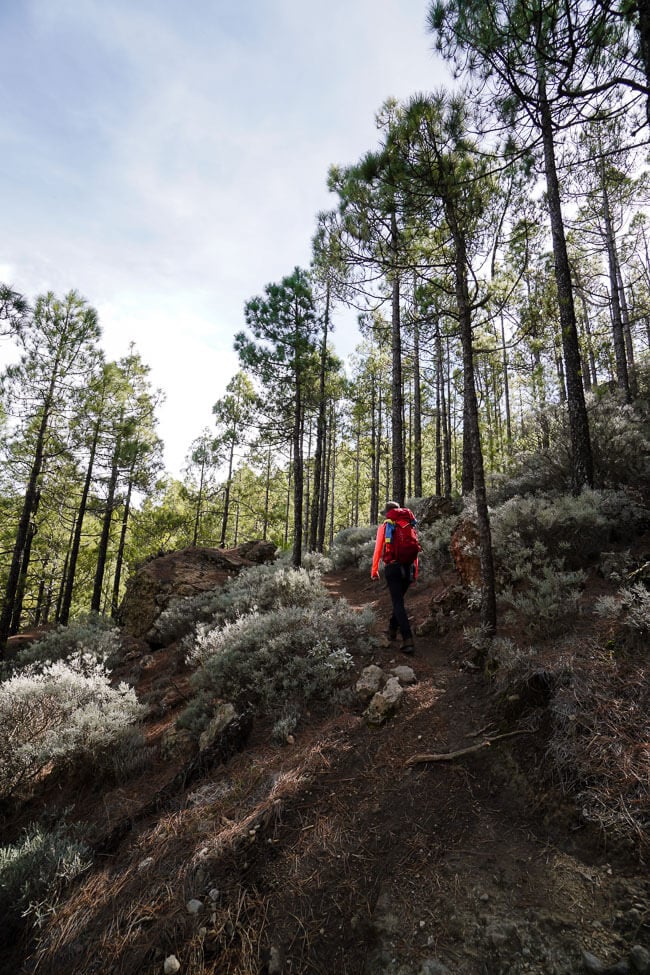
At the Degollada Los Hornos trail junction, the trail to Pico de las Nieves branches off the Silver Route and steadily ascends a gorgeous Canary Island Pine forest, strewn with white sage, all the way up to the summit.
Cruz Grande to Pico de las Nieves Trail Stats
Trailhead | Cruz Grande
Distance | 15.2 km out-and-back
Time Needed | 6 hours
Difficulty | Moderate – Moderately Difficult
Where to Stay | Parador de Cruz de Tejeda (hotel) in Cruz de Tejeda, Calma Suites Tejeda (modern apartments), Hotel Rural Fonda De La Tea (B&B) or Vivienda Vacacional La Portada (apartment) in Tejeda.
Learn More: Cruz Grande to Pico de las Nieves Trail Guide
6. Roque Nublo

Roque Nublo, which means “Cloud Rock,” is a 65 meter tall volcanic rock standing on a high platform. It was formed by a volcanic eruption around 4.5 million years ago. At 1813 meters, Roque Nublo is the third highest summit on the island.
This top landmark is located in the mountainous center of Gran Canaria in the municipality of Tejeda. It’s distinct shape is easy to spot from multiple viewpoints and villages across the island.
Access to Roque Nublo is free and simple with a car. Simply drive to Degollada de La Goleta, along the GC-600, and walk 1.5 km to the Roque Nublo plateau. This is the shortest route to Roque Nublo.
You can extend this hike by following the forest trail that loops around Roque Nublo.
Roque Nublo Trail Stats
Trailhead | Degollada de La Goleta
Distance | 3 km out-and-back
Time Needed | 1:15 hours
Difficulty | Easy
Where to Stay | Parador de Cruz de Tejeda (hotel) in Cruz de Tejeda, Calma Suites Tejeda (modern apartments), Hotel Rural Fonda De La Tea (B&B) or Vivienda Vacacional La Portada (apartment) in Tejeda.
Learn More: Roque Nublo Hiking Guide
7. Cruz de Tejeda to La Culata Circuit

The Cruz de Tejeda to La Culata circuit hike links together the best viewpoints of Central Gran Canaria.
Starting from the high vantage point of Cruz de Tejeda, the hike initially follows a high trail to Mirador de Degollada Becerra and Degollada de la Cumbre with sweeping views of the Tejeda ravine, Tejeda basin, Roque Nublo and Roque Bentayga.
Next, the path enters a forest and descends to the Presa de los Hornos dam, just below the Mirador Presa de los Hornos viewpoint.
From here, the trail continues to descend to La Culata village, a farming settlement in the municipality of Tejeda.
From the village center, marked by two restaurants, the circuit trail weaves up the village all the way up to Degollada de la Cumbre.
The final leg of the hike follows the already-hiked high trail to Cruz de Tejeda.
Cruz de Tejeda to La Culata Circuit Trail Stats
Trailhead | Cruz de Tejeda
Distance | 14.7 km lollipop-circuit
Time Needed | 5:45 hours
Difficulty | Moderate – Moderately Difficult
Where to Stay | Parador de Cruz de Tejeda (hotel) in Cruz de Tejeda, Calma Suites Tejeda (modern apartments), Hotel Rural Fonda De La Tea (B&B) or Vivienda Vacacional La Portada (apartment) in Tejeda.
Learn More: Cruz de Tejeda to La Culata Circuit Trail Guide
8. Cruz de Tejeda to Cuevas del Caballero Caves

The hike from Cruz de Tejeda to Cuevas del Caballero is an outstanding half-day outing with sweeping views of the cliffs and ravines of the collapsed volcanic crater of Tejeda.
Cruz de Tejeda, the geographical center of Gran Canaria, is located at the crossroads of the GC-15 and GC-150, high above Tejeda village. At Cruz de Tejeda, you’ll find a bar, restaurant, tourist office, the Parador de Cruz de Tejeda Hotel, and a large parking lot.
Starting at the parking lot, this route follows a high trail to the Mirador Degollada de las Palomas viewpoint and then onwards to the fertility caves of Cuevas del Caballero.
Cruz de Tejeda to Cuevas del Caballero Caves Trail Stats
Trailhead | Cruz de Tejeda
Distance | 7 km lollipop-circuit
Time Needed | 3 hours
Difficulty | Easy
Where to Stay | Parador de Cruz de Tejeda (hotel) in Cruz de Tejeda, Hotel Rural Fonda De La Tea (B&B) or Vivienda Vacacional La Portada (apartment) in Tejeda.
Learn More: Cruz de Tejeda to Cueva del Caballero Hike
9. Alta Vista Peak

Altavista is a panoramic mountain in northwest Gran Canaria in Tamadaba Natural Park. The summit overlooks the town of La Aldea surrounded by banana plantations and the rugged west coast. Tenerife’s Pico del Teide is also clearly visible.
This hike starts at the Mirador del Sargento viewpoint, along the GC-216 road, 5 km west of Artenara. A leisurely high-altitude trail follows a crest and runs through a beautiful Canary Pine forest.
Along the way, you’ll see the Plateau of Acusa Verde and the Tejeda Caldera with its notable summits: Roque Nublo, Roque Bentayga, and Pico de las Nieves.
Before reaching the summit, the trail zigzags down to the saddle of Lajas del Jabon, along a loose rocky path. From here, it’s a 20-25 minute ascent to the peak. The path forks a few times. Always stick to the main path.
Alta Vista Peak Trail Stats
Trailhead | Mirador del Sargento
Distance | 10.1 km out-and-back
Time Needed | 4:15 hours
Difficulty | Moderate
Where to Stay | Parador de Cruz de Tejeda (hotel) in Cruz de Tejeda, Calma Suites Tejeda (modern apartments), Hotel Rural Fonda De La Tea (B&B) or Vivienda Vacacional La Portada (apartment) in Tejeda
Learn More: Altavista Peak Hike Trail Guide (Coming Soon)
10. Roque Faneque

Roque Faneque is a panoramic cliff in Tamada Natural Park, a Unesco Biosphere Reserve, in Gran Canaria. A quick and easy out-and-back hike descends from Casa Forestal to the Roque Faneque viewpoint in 1 hour.
This is a fantastic excursion for hikers wanting to sample the beauty of the Tamadaba pine forest and those seeking a bird’s-eye view of the rugged west coast of Gran Canaria and the Atlantic Ocean.
On clear days, views extend to Puerto de las Nieves, Agaete, and Gáldar. The trail is signed and sporadically waymarked.
Roque Faneque Trail Stats
Trailhead | Casa Forestal de Tamadaba
Distance | 4.8 km out-and-back
Time Needed | 2 hours
Difficulty | Easy – Moderate
Where to Stay | Parador de Cruz de Tejeda (hotel) in Cruz de Tejeda, Calma Suites Tejeda (modern apartments), Hotel Rural Fonda De La Tea (B&B) or Vivienda Vacacional La Portada (apartment) in Tejeda.
Learn More: Roque Faneque Hike
Where to Stay in Gran Canaria for Hiking

The best Gran Canaria hikes are concentrated in the northwest around Puerto de las Nieves/Agaete and in the interior around Cruz de Tejeda/Tejeda.
If you’re planning a hiking trip, simply divide your time between these two destinations.
Puerto de las Nieves
We highly recommend staying in the fishing village of Puerto de las Nieves, which is also the port of Agaete. The best accommodation is Hotel & Spa Cordial Roca Negra.
Puerto de las Nieves is very charming and has a lot to offer: multiple harbor-side restaurants, a scenic beach, a wonderful promenade, and public volcanic rock pools.
Midrange | Hotel Puerto de Las Nieves is centrally located in Puerto de las Nieves, a short walk to the port restaurants, Playa de las Nieves beach, and Agaete Piscina Natural pools. Breakfast is included in the room rate. Hotel features include indoor swimming pool, indoor whirlpool, and a free private underground parking garage.
Luxury | Hotel & Spa Cordial Roca Negra is the finest accommodation in Puerto de las Nieves, Agaete, featuring a swimming pool, whirlpool, sky rooftop bar, on-site restaurant, and spa (extra charge). The hotel occupies an elevated position on a cliff, overlooking the Atlantic Ocean. It’s connected to the coastal promenade and the Agaete natural pools by a pedestrian stairway path (4 minute walk).
Rooms are modern, spacious and very comfortable. Breakfast is included in the rate, and half board is optional. The staff is attentive and eager to please. Guests can park along the street for free, or park in the hotel’s paid parking garage.
Look for accommodation in Puerto de las Nieves.
Agaete
The white-washed town of Agaete is located inland, about 1.3 km from the Puerto de las Nieves and the coast. Though it’s a lovely town, it’s not as animated as Puerto de las Nieves.
If you stay in Agaete, you can walk to Puerto de las Nieves in 15-20 minutes. Agaete, however, has more budget-friendly options including Casa Calma Yoga Guesthouse (hostel), Casa Luna (guesthouse), and Harizan (apartment).
Budget | Casa Calma Yoga Guesthouse is a cheerful and social hostel in Agaete, offering double rooms as well as dormitory beds. All rooms have a shared bathroom and shower. Guests have access to a shared kitchen and lounge. Stay here if you want to connect with other travelers.
Look for accommodation in Agaete.
Cruz de Tejeda
Cruz de Tejeda (1514 m) is a small hamlet situated on the crossroads of GC-150 and GC-15, high above the town center of Tejeda. Cruz de Tejeda serves as a viewpoint, pit stop, and trailhead.
Multiple hiking trails start here, including the Cuevas del Caballero Caves hike, Cruz de Tejeda to Culata Circuit, and the hike to Tejeda.
With its advantageous location and close proximity to other trailheads (Degollada de Becerra, Llano de la Pez, Degollada de la Goleta, and even Cruz Grande), Cruz de Tejeda is an ideal base for hiking.
Luxury | Parador de Cruz de Tejeda is an iconic mountainside hotel overlooking the Tejeda basin. Stay here for the sweeping views of the Tejeda basin and the comfortable rooms with balconies. The cherry on top is the on-site spa and the infinity pool spilling out towards the caldera. If you stay here, make a reservation for the spa in advance.
Tejeda
Situated on the eastern edge of the caldera de Tejeda (volcanic crater of Tejeda), the white-washed town of Tejeda (1050 m) is arguably the most beautiful town on the island.
The town center is home to a famous bakery, Dulcería Nublo, an artisan gelateria, Heladería LaLexe, the upscale canary restaurant and brewery Texeda, as well as a number of other eateries.
Best Choice – Midrange | The modern and stylish apartments of Calma Suites Tejeda are outfitted with fully equipped kitchens and parquet floors. There’s free on-site parking.
Midrange | Hotel Rural Fonda De La Tea is a welcoming bed and breakfast in the town center of Tejeda. Guests love the mountain views, the friendly service, overall cleanliness, and the private terrace.
Budget-Midrange | Vivienda Vacacional La Portada is a top-rated, spotless apartment in the heart of Tejeda with a well-equipped kitchen and terrace facing Roque Nublo and Roque Bentayga.
Look for accommodation in Tejeda.

More Gran Canaria and Spain Travel Guides
Hiking in Gran Canaria: Learn more about hiking in Best Hikes in Gran Canaria.
Gran Canaria Trip Planning: Read Adventurous Things to Do in Gran Ganaria. Also, check out all our articles about Gran Canaria.
Tenerife: Plan a trip to Tenerife using this Tenerife Road Trip Itinerary and these guides:
- Hiking Tenerife: Best Hikes in the Tenerife Mountains
- Where to Stay in Tenerife for Hiking
- Tenerife in January
- How to Visit Anaga Rural Park
- How to Visit Teide National Park
Mallorca Trip Planning: Read Where to Stay in Mallorca for a summary of the most scenic destinations and best accommodations on the island. If you’re eager to see the best parts of the island, we suggest following this 7-Day Mallorca Road Trip.
Hiking in Mallorca: For tips on hiking in Mallorca, read Best Hikes in Mallorca.
Spain: Read the latest articles in our Spain Travel Guide and Spain blog archive.
Hiking in Europe: We’re passionate about writing about the most beautiful and interesting hiking hiking trails in Europe. Read next:
- Best Hikes in Malta
- Best Hikes in Portugal
- Best Hikes in Slovenia
- Best Day Hikes in Austria
- Best Day Hikes in the Dolomites
- Best Day Hikes in Europe
Gran Canaria Hiking & Travel Essentials
Gran Canaria Guidebooks
- Travel Guidebook: DK Eyewitness Top 10 Gran Canaria
- Travel Guidebook: Gran Canaria Marco Polo Pocket Guide
- Hiking Guidebook: Cicerone: Walking on Gran Canaria
- Hiking Guidebook: Rother: Gran Canaria
Guided Adventures in Gran Canaria
South Gran Canaria:
- From Bahía Feliz, close to Maspalomas: Cliff Climbing Via Ferrata Trip
- From Playa del Inglés: Surfing Class for Beginners
- From Puerto de Mogan: Boat and Snorkeling Trip
- From Puerto Rico: Scuba Diving for Beginners
- From Puerto Rico: Dolphin Watching & Güi Güi Beach by Boat
- From Playa del Inglés to Mogan: Scuba Diving for Beginners
Las Palmas and North Gran Canaria:
- From Telde: Canyoning Trip
- From Las Palmas: Las Canteras Beach 3-Hour Snorkeling Trip
- From Las Palmas: Canteras Beach: Scuba Diving Discovery Tour
Hiking Gear Packing List
- Day Pack: Osprey Tempest 30 Women’s Backpack / Osprey Talon 33 Men’s Backpack
- Hiking Backpack: Osprey Tempest 30 Women’s Backpack / Osprey Talon 33 Men’s Backpack
- Grade B or B/C Hiking Boots: Meindl Schuhe Island Lady (Kati’s Boots), Women’s Hanwag Tatra II GTX (Sabrina’s Boots), Men’s Hanwag Tatra II GTX (men’s equivalent)
- Hiking Poles (Optional): Black Diamond Trail Trekking Poles
- CAT 4 Sunglasses: Julbo Shield Mountain Sunglasses
- Reusable Water Bottle: Ion 1 Litre Water Bottle
Travel Photography Gear
- Camera Body: Sony Alpha a6400
- Mid-range Zoom Lens: Sony Vario-Tessar 16-70mm F4 ZA OSS ZEISS
- Wide angle Zoom Lens: Sony – E 10-18mm F4 OSS Wide-angle Zoom Lens
- Backpack Camera Clip: Peak Design Camera Clip
