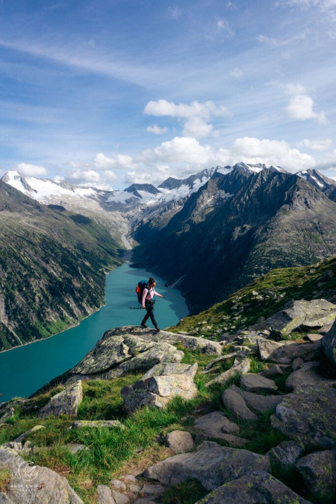
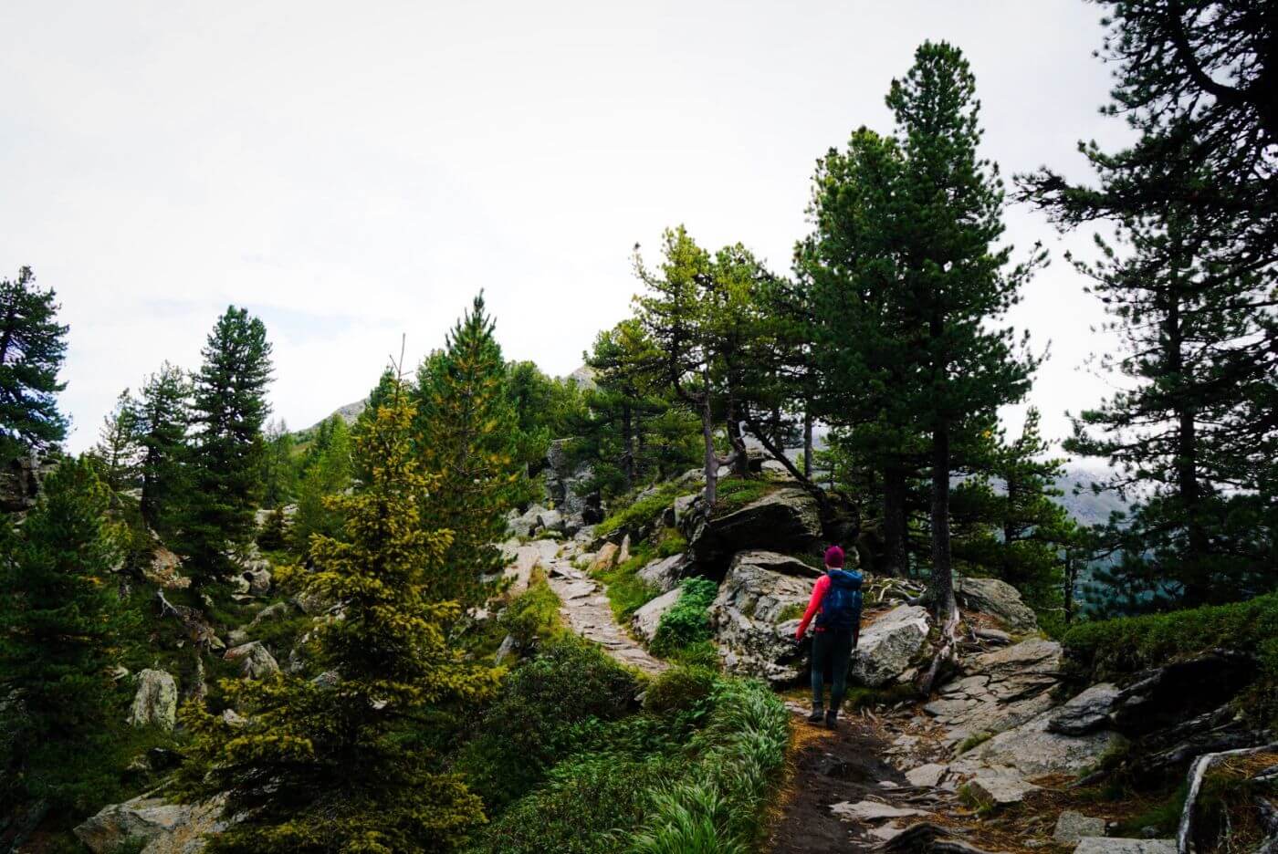
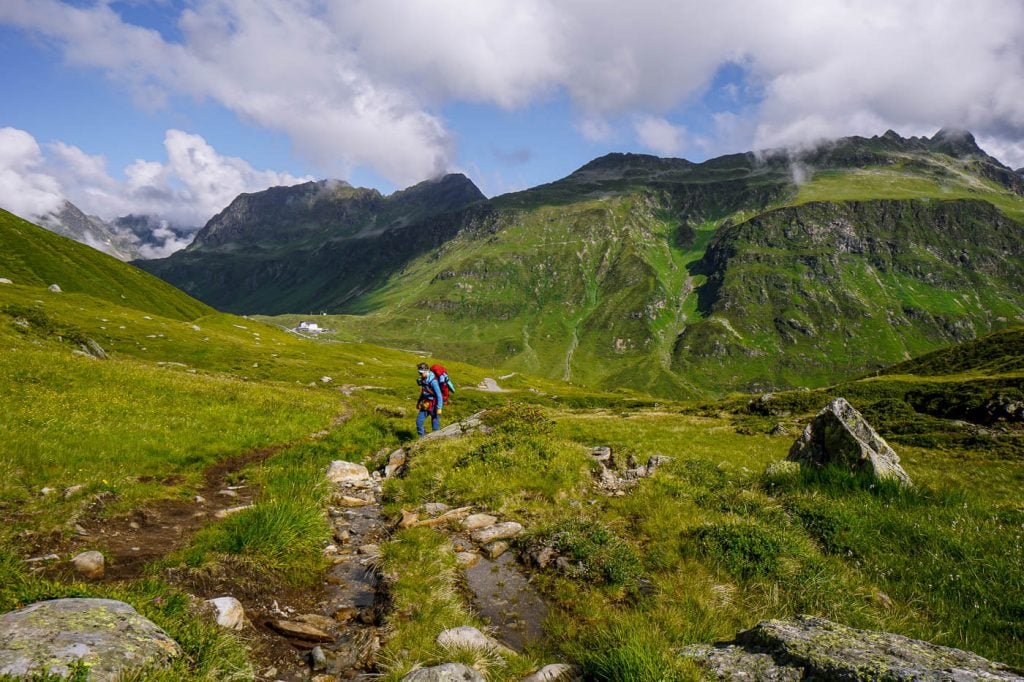
Hiking in Austria is far more than exercise; it’s a window into Austrian culture. As you journey on foot into the Austrian Alps, you can experience mountain pasture culture, culinary traditions, and historic mountain huts.
The Austrian Alps stretch across most of the country, with the highest peaks in the states of Tyrol, Carinthia, and Salzburg.
With so many ranges to choose from, it can be a bit daunting to figure out where to go. The mountains of Austria require lifetimes to explore.
We’re determined to uncover the best hiking trails in Austria, one summer at a time. So, below you’ll find our favorite day hikes in Austria to date, including hikes in the Wachau Valley, Zillertal Alps, Karwendel Mountains, Mieming Range, Rätikon Alps, Lechquellen Mountains, Lienz Dolomites, Dachstein, Schaldminger Tauern, Silvretta Alps, Hohe Tauern, and Radstädter Tauern.
This post will continue to grow, so do check back in at the end of the summer, or even next year.
If you’re interested in hut-to-hut hikes in Austria, read Trekking Austria and Hut to Hut Hiking in Austria.
- When to Hike in Austria: The best time to hike in the Austrian Alps is between mid/late June and mid/late September.
- Trail Signage and Waymarking: Excellent
- Recommended Hiking Destinations: Schladming, Filzmoos, Lech, Mayrhofen, Innsbruck, Lake Achensee
- Payment culture: Always bring EUR cash when hiking and traveling in Austria. You’ll need cash for toll roads, parking machines, and huts (food & drinks).
- Alpine Pastures: Many hiking trails traverse alpine pastures, where cattle and other livestock graze during the summer months. Respect the animals and do not disturb, touch, or provoke them.
- Mountain Huts: Mountain huts (Hütte, Hütten) accommodate overnight guests throughout the hiking season (June-September). Opening/closing times are dependent on the location of the hut (elevation) and snow/weather conditions. Day hikers can also visit huts for food & drinks during the day.
Best Hikes in Austria Map
How to Read this Map | Color signifies Austrian state. For example, all day hiking trails in the state of Tyrol are highlighted in coral red. Click on the trails and icons to learn more about each trail.
AUSTRIAN STATES
Tyrol Hikes
Carinthia Hikes
Styria Hikes
Lower Austria Hikes
Getting Around Austria
Austria has an excellent public transit system. We’ve used it extensively to travel throughout the country. We highly recommend using transit if you’re visiting cities (Vienna, Salzburg, Innsbruck, Graz, etc…), and/or doing multi-day hikes.
Some areas like Mayrhofen, Schladming and Lech am Arlberg have wonderful seasonal transit systems in place (e.g. summer hiking buses). However, if you’re not visiting during the high season, bus frequencies are significantly reduced and it’s far easier to get around with your own vehicle.
If you’re planning on visiting multiple destinations across Austria, we recommend renting a car.
Car Rental
We recommend using the Discovercars.com car rental reservation platform to search for and book car rentals in Austria. This easy-to-use booking platform compares car rental deals from 500+ trusted providers, so that you can choose the best option for your trip.
Tip: If you can only drive automatic transmission cars, as opposed to manual transmission cars (stick shift), book your car rental as early as possible.
Hiking-Themed Austria Itineraries
Use these road trip itineraries for inspiration:
2-Week Austria Road Trip – starting in Vienna
7-Day Austria Road Trip – starting in Salzburg or Munich
10-Day Bavarian Alps and Tyrolean Alps Road Trip – starting in Munich
1. Dürnstein to Krems: Wachau Word Heritage Trail

The Wachau World Heritage Trail is a 180 km long-distance hiking trail in the Wachau Valley in Lower Austria. The trail is broken down into 14 stages.
The first stage, Krems to Dürnstein, is particularly scenic, because of its sweeping views of the sinuous Danube River and the steep terraced vineyards.
It’s an easy, undulating trail, suitable for everyone. Stage 1 of the World Heritage Trail leads initially up to the Dürnstein castle ruins and then through vineyards, pockets of forest, and ultimately through the wine cellar alleys of Stein and Krems.
We love this point-to-point hike because it’s picturesque, easy and you can walk it at anytime of the year.
It’s also an excellent day trip from Vienna.
If you’re spending more time in the Wachau, also check out these trails: Vogelbergsteig and Seekopf and Hirschwand.
Wachau World Heritage Trail Stage 1 Trail Stats
Starting Point | Dürnstein, Wachau Valley, Lower Austria
Ending Point | Krems, Wachau Valley, Lower Austria
Distance | 12.5 km point-to-point
Time Needed | 4 – 4:30 hours
Elevation Gain | 357 meters
Elevation Loss | 361 meters
Difficulty | Easy
When to Hike | All-year-round
Where to Stay in Dürnstein | Gästezimmer Rolea (budget), or Bioweingut Schmidl (midrange)
Where to Stay in Krems | Hotel Unter Den Linden (midrange), or Klinglhuber Suites (luxury)
Learn More: Dürnstein to Krems Day Hike
2. Lünersee Circuit Trail

Lünersee is a large alpine lake high above Brand Valley in the Austrian State of Vorarlberg.
Set amidst the striking limestone mountains of the Rätikon, this beautiful lake is a scenic destination for casual walking as well as strenuous hiking.
The Lünerseebahn cable car connects Brand Valley to Lake Lünersee. It’s typically open from late May until late October. See Opening Times and Prices here.
This circuit hike around Lünersee is suitable for everyone, including families with small children. If you want to extend your hike into a full-day adventure, we recommend hiking to Schesaplana (2964 m), the highest mountain in the Rätikon Alps.
This stunning lake is also the starting point for the Rätikon Circuit Trail, a 4-5 stage hut-to-hut hiking trail.
Lake Lünersee Circuit Trail Stats
Trailhead | Douglashütte, Brand Valley, Rätikon Alps, Vorarlberg
Distance | 6.1 km circuit
Time Needed | 2 hours
Difficulty | Easy
When to Go | Late May – Late October
Where to Stay in Brand | Hotel Lün (midrange), Pension Bergkristall (midrange), or Bike and Board Lodge (luxury)
Learn More: Lünersee Hiking Guide
3. Stone Pine Path
The Stone Pine Path (“Zirbenweg” in German) is a blissfully easy walking path in the Tux Alps, high above the Inntal Valley in Tirol.
The Stone Pine Trail connects the Patscherkofelbahn mountain station with the Glungezerbahn mountain station, running at a high altitude (2000 meters) with very minimal elevation gain/loss.
It’s called the Stone Pine Trail because it leads through one of the oldest and largest stone pine stands in Europe.
This undulating panoramic trail invites you to breathe deeply, slow down, and contemplate your next Zirbenschnaps.
This easy walk is a perfect activity if you’re hiking with children, hunting for viewpoints of the Inntal Valley, visiting Hall in Tirol or Innsbruck, or simply craving fresh air.
Zirbenweg Trail Stats
Starting Point | Patscherkofelbahn cable car mountain station, Igls, Tux Alps, Tirol
Ending Point | Glungezerbahn mountain station, Tulfes
Distance | 7 km point-to-point
Time Needed | 2:30 hours
Elevation Gain | 200 meters
Elevation Loss | 90 meters
Difficulty | Easy
When to Hike | Late May – Early October, when cable cars are operating
Where to Stay in Lans and Tulfes | Am sonnigen Waldrand in Lans (budget), B&B Appartements Glungezer in Tulfes (midrange) or Gasthof Walzl in Lans (luxury)
Where to Stay in Innsbruck | Motel One Innsbruck (budget-midrange), Faktorei (midrange-luxury), Altstadthotel Weisses Kreuz (luxury), or Weisses Rössl (luxury)
Learn More: Stone Pine Trail
4. Wolfsklamm Gorge

Wolfsklamm is a river gorge in the Karwendel Mountains in Tyrol.
The gateway to the gorge is Stans, a village in the Inntal Valley, 30 km east of Innsbruck. You can reach Stans by train, or by car.
Between May and October, hikers can enter this impressively narrow river gorge. A heavily-bolstered path, made up of stairs, railings, bridges, and fixed cables, clings to the gorge wall and steeply ascends the limestone chasm.
Like other gorge trails that require regular maintenance, there is a small entrance fee to enter (5 EUR for adults, 1.50 EUR for kids).
Due to safety reasons, it’s only possible to hike one-way up through Wolfsklamm. At the end of the trail, you can extend the hike to the Benedictine Monastery of St. Georgenberg, where there’s a restaurant. Or, you can descend immediately along the Way of the Cross via “Weng” trail.
If you’re planning a trip to Innsbruck, also check out the Nockspitze summit hike (moderately difficult) and Hundskopf summit hike (difficult).
Wolf’s Gorge Trail Stats
Trailhead | Parkplatz Wolfsklamm, Stans, Tyrol
Distance | 5.4 km circuit
Time Needed | 2:15 hours
Elevation Gain/Loss | 410 meters
Difficulty | Moderate
Where to Stay in Innsbruck | Motel One Innsbruck (budget-midrange), Faktorei (midrange-luxury), Altstadthotel Weisses Kreuz (luxury), or Weisses Rössl (luxury)
Learn More: Wolfsklamm Hiking Guide
5. Mühlbach High Trail (Salzburger Almenweg Stage 2) with Hochkeil Summit

The Salzburger Almenweg is a 31-stage long-distance hiking trail in Salzburg State. As the name suggests, this is a thematic hiking trail linking the region’s Almen (alpine pastures) and Almhütten (alpine pasture huts). The entire circuit is 350 km and connects 120 mountain huts. You can hike different stages of the trail as point-to-point day hikes, like stage 2.
Stage 2 of the Salzburger Almenweg, the Mühlbach High Trail, is a particularly lovely trail at the base of the Hochkönig mountains.
The trail traverses mountain pastures and pockets of forest, passing several alpine pasture huts along the way, including the “Vier Hütten” (Four Huts).
You can start the hike at either Arthurhaus (paid car park/bus stop) high above Mühlbach am Hochkönig, or at the Erichhütte car park (free car park/bus stop) along the Hochkönigstraße road in Dienten am Hochkönig.
We parked at the Erichhütte car park and took Bus 593 to Arthurhaus and then hiked back to our car. The bus takes 40 minutes and costs 5.10 EUR per person. You can pay the bus driver directly with either cash or card.
Since this is a relatively short route, we recommend extending this hike to the Hochkeil summit from Arthurhaus, or to the Taghaube summit from Erichhütte.
Arthurhaus to Erich Hut Trail Stats
Starting Point | Arthurhaus, Mühlbach am Hochkönig, Hochkönig Mountains, Salzburg
Ending Point | Erichhütte Car Park, Dienten am Hochkönig
Distance | 11.2 km point-to-point
Time Needed | 3:30 hours
Elevation Gain | 226 meters
Elevation Loss | 377 meters
Difficulty | Easy
Where to Stay in Mühlbach am Hochkönig | Landhaus Rieding (midrange) Das Grünholz Aparthotel & Restaurant (luxury), Hotel Bergheimat (luxury)
Where to Stay in Dienten am Hochkönig | The Peak Hochkönig (luxury)
Learn More: Mühlbach High Trail
6. Five Huts Trail

The 5 Huts Trail (“5 Hüttenweg” in German) is a highly enjoyable day hike in Ramsau am Dachstein in Styria.
With very little effort, you’ll be rewarded with spectacular views of the southern slopes of the Dachstein massif, as you traverse alpine pastures, larch forests, and meadows.
Five Huts Trail Stats
Trailhead | Ramsau am Dachstein, Dachstein Mountains, Styria
Distance | 14 km circuit
Time Needed | 5 hours
Elevation Gain/Loss | 887 meters
Difficulty | Easy – Moderate
When to Hike | May – October
Where to Stay in Ramsau am Dachstein | Reitercamp Ortnerhof (budget), Der Brückenhof Ramsau (midrange), or Rittis Alpin Chalets Dachstein (luxury)
Learn More: 5 Huts Trail in the Dachstein
7. Lake Tappenkarsee

Tappenkarsee is a mountain lake nestled in the Radstädter Tauern Mountains of Austria.
This Salzburg lake is a satisfying hiking destination, because it’s cradled by rugged mountains and home to the rustic Tappenkarsee Alm (alpine pasture hut) and charming Tappenkarseehütte (mountain hut). These managed huts are usually open from early June until mid/late September.
To start the hike, drive or take a bus to Lake Jägersee in Kleinarl Valley. Jägersee is 4 km south of Kleinarl and 11.6 km south of Wagrain. If the toll road is open, continue driving 3.6 km to Schwabalm car park. If the toll road is closed, park at the Jägersee Car Park.
After hiking up a series of serpentines through a mixed forest to Tappenkarsee, follow the lakeshore to the Tappenkarsee Alm and onwards to the Tappenkarsee Hut.
Continue ascending to Draugsteintörl saddle. This trail traverses slopes and pastureland, rewarding hikers with ever-changing vistas of the lake. From the saddle, descend to Tappenkarsee Alm and return to the trailhead along the same route.
Lake Tappenkarsee Trail Stats
Trailhead | Jägersee Car Park / Jägersee Bus Stop, Kleinarl Valley, Radstädter Tauern, Salzburg
Distance | 19.9 km lollipop-circuit
Time Needed | 7 hours
Elevation Gain/Loss | 985 meters
Difficulty | Moderate
Where to Stay in Kleinarl | Privatzimmer/Apartments Schwarzenbacher (budget) or Hotel Ennskraxblick (midrange)
Where to Stay in Wagrain | Wanderhotel Erika (midrange) or The MATTHEW – Copper Lodge (luxury)
Learn More: Tappenkarsee Trail Guide
8. Gramaialm – Lamsenjochhütte – Hahnkampel Circuit Trail

This scenic trail in Karwendel Nature Park starts in Falzturntal Valley, accessible from Pertisau, a holiday village on the southwestern shore of Lake Achensee.
From the park at Gramai Alm (toll fee applies), the trail ascends moderately to Lamsenjochhütte (2 hours).
After lunch, or a break at the hut, the hike continues to the Western Lamsenjoch saddle, which is the starting point of the Hahnkampl ridge trail.
With sweeping views of Grosser Ahornboden and the impressive Hinterautal-Vomper-Kette chain of the Karwendel range, the trail progresses along the ridge to the Hahnkampl summit. The initial descent in the direction of Binssattel is rugged, but quickly smooths out.
From the Binssattel saddle, the trail crosses mountain pastures to reach the Gramai-Hochleger hut. The descent continues to Gramaialm.
Trail Stats
Trailhead | Gramai Alm, Pertisau
Distance | 11.1 km circuit
Time Needed | 4:45 hours
Elevation Gain/Loss | 869 meters
Difficulty | Moderate-Moderately Difficult
Minimum Elevation | 1262 meters
Maximum Elevation | 2080 meters
Learn More: Gramaialm – Hahnkampl Circuit Hike
9. Hofpürgl Hut to Sulzenalm Circuit Trail

This grand circuit hike in Filzmoos runs along the base of Bischofsmütze and Gosaustein in the Dachstein Mountains.
It starts at the end of the Hofalm toll road (5.50 EUR per car, cash only), north of Filzmoos.
The hike begins with a steady ascent to Hofpürglhütte (1705 m), the refuge perched on a ridge beneath the Bischofsmütze twin peaks.
As you gain elevation, the Gosaukamm/Dachstein range seems to spread its wings like a butterfly. After hiking up to Hofpürglhütte (50 minutes), the route follows the Linzerweg (Linzer Steig) across the boulder-filled Kesselwand beneath Bischofsmütze.
The undulating path continues east across graben, spurs, and boulder fields to Rinderfeld, a huge sprawling pasture below soaring limestone walls. After crossing this gorgeous meadow, the trail drops below the treeline and then zigzags up to the Sulzenschneid Spur.
Crest he spur and continue to the highest point, Eiskarlschneid, marked by a summit cross.
The trail descends to the Sulzenhals saddle and wanders through dwarf pine and later larches to reach the rolling pasture area of Sulzenalm.
Sulzenalm is home to two enticing huts, Wallehenhütte and Krahlehenhütte, which serve delicious meals throughout the day.
From Sulzenalm, it’s a 45-minute descent to Hofalm.
Hofpürgl Hut to Sulzenalm Trail Stats
Trailhead | Hofalm, Filzmoos, Dachstein Mountains, Salzburg
Distance | 12.9 km circuit
Time Needed | 5:15 hours
Difficulty | Moderate
Elevation Gain/Loss | 912 meters
When to Hike | June – October, depending on weather conditions
Where to Stay in Filzmoos | Bauernhof Krahlehenhof (midrange), Das Anja Alt Filzmoos (midrange), meiZeit Lodge (luxury)
Learn More: Hofpürgl Hut to Sulzenalm Circuit Hike
10. Lake Formarinsee to Lake Spullersee

The day hike from Lake Formarinsee to Lake Spullersee gives you an outstanding overview of the enchanting Lechquellen Mountains in Vorarlberg. The River Lech originates within the range at Lake Formarinsee, which is why it’s called “Lech Source Mountains.”
From the village of Lech am Arlberg, take bus 7 to Formarinsee. These buses don’t run very frequently, so make sure to plan ahead. From the bus stop, hike around Lake Formarinsee to the mountain hut Freiburger Hütte. Enjoy the views of Rote Wand, the “red wall” mountain.
Starting at Freiburger hut, the trail ascends gently through wildflower-carpeted slopes and alpine pastures to Steinernes Meer (“Stone Sea”), an impressive karst landscape. After traversing the Stone Sea, continue your ascent to the Gehrengrat mountain ridge. Next, follow the ridge downhill in the direction of Lake Spullersee.
We love this Austrian hike, because of the romantic alpine scenery and the interesting and varied terrain.
Formarinsee to Spullersee Trail Stats
Trailhead | Lake Formarinsee, Zugertal Valley, Lechquellen Mountains, Vorarlberg
Distance | 11.4 km point-to-point
Time Needed | 4:30 – 5 hours
Elevation Gain | 637 meters
Elevation Loss | 673 meters
Difficulty | Moderate – Difficult, depending on weather conditions
When to Hike | Late June – Late September, when the hiking buses are operating
Where to Stay in Lech am Arlberg | Lech Hostel (budget), Haus Braunarl (midrange), Hotel Auenhof (luxury), or Hotel Berghof (luxury)
Learn More: Formarinsee to Spullersee Day Hike
11. Glacier Trail Pasterze

The spellbinding Glacier Trail Pasterze (Gletscherweg Pasterze) is located in Hohe Tauern National Park, just off the Grossglockner High Alpine Road.
Well-marked and easy-to-follow, the hike delivers unbeatable views of Austria’s highest mountain, Grossglockner (3798 m), and the rapidly receding Pasterze Glacier.
This route is also part of the first stage of the Alpe Adria long-distance trail, which starts at Kaiser-Franz-Josefs-Höhe and ends in Heiligenblut.
Though you can hike in either direction, we recommend starting at the Glocknerhaus, because the views unfold spectacularly as you near the foot of Grossglockner.
Initially, the trail descends from Glocknerhaus to the Margaritzenstausee reservoir and then continues left along the water and over two reservoir cement walls. The water of Pasterze Glacier feeds Margaritzenstausee.
Next, the trail ascends to Lake Sandersee, where there’s an impressive view of Pasterze and Grossglockner.
Continue all the way up to Kaiser-Franz-Josefs-Höhe. It’s possible to take a regional bus back to Glocknerhaus. However, these busses are very infrequent (max 3 per day).
Inside Glocknerhaus, there’s a timetable for the regional bus, which you can check before you set off.
Pasterze Glacier Trail Stats
Trailhead | Glocknerhaus (2132 m), Grossglockner High Alpine Road, Hohe Tauern National Park, Carinthia
Distance | 7.8 km circuit
Time Needed | 3 hours
Elevation Gain/Loss | 444 meters
Difficulty | Moderate
When to Hike | June – September, when the Grossglockner High Alpine Road is open
Where to Stay in Heiligenblut am Großglockner | Wallackhaus RegioJet Hotels (budget), Hotel Kaiservilla (midrange), or Nationalpark Lodge Grossglockner (luxury)
12. Gaistal Valley – Rotmoosalm – Wetterstein Hut Circuit Trail

This day hike in the Wetterstein Mountains of Tyrol links together picturesque mountain pastures and mountain huts: Hämmermoosalm, Rotmoosalm, Wangalm, and Wettersteinhütte.
The trail starts near near Leutasch and Seefeld in Tirol in Gaistal, the valley that runs between the Mieminger Chain and the Wetterstein Gebirge.
The whole route is enjoyable and varied, weaving across boulder-studded slopes, high meadows, and mixed forests. Views of the towering Wetterstein Massif South Wall will leave a lasting impression.
Though there are some steep ascents and the trail is long, there is no technical difficulty.
Trail Stats
Trailhead | Salzbach Car Park in Gaistal (P5), Leutasch, Tyrol
Distance | 17.6 km lollipop-circuit
Time Needed | 6:30 hours
Elevation Gain/Loss | 910 meters
Difficulty | Moderate
When to Hike | June – October
Where to Stay in Seefeld in Tirol | Hotel Residence Metropol (budget), Apart Simon Seefeld (budget), Tiroler Weinstube (midrange), Summit Seefeld (midrange-luxury), or Hotel Klosterbräu (luxury).
Learn More: Gaistal – Rotmoosalm Circuit Trail
13. Hohes Rad Circuit Trail
Hohes Rad (“High Wheel”) is a mountain in the Silvretta Alps. The peak straddles the border between Tirol and Vorarlberg.
A wonderful hiking trail wraps around Hohes Rad (2934 m), starting at Silvretta Bielerhöhe (2037 m), a high mountain pass connecting Montafon Valley in Vorarlberg with Paznaun Valley in Tirol.
From the Silvretta Reservoir, the trail gently ascends Bieltal Valley to the Radsattel mountain saddle. From the saddle, you can detour to the summit of Hohes Rad (3 hours out-and-back) – a challenging peak hike best undertaken by experienced hikers.
The circuit trail continues over the Rad saddle, ultimately descending to Wiesbadener Hütte (2443 m), a mountain refuge set amidst a frozen world of ice, water, and rock. From this impressive mountaineering hut, the trail descends the Ochsental Valley back to the Silvretta Reservoir.
Hohes Rad Circuit Trail Stats
Trailhead | Silvretta Bielerhöhe (2037 m), Silvretta Alps, Vorarlberg & Tirol
Distance | 14.8 km circuit
Time Needed | 5 hours
Elevation Gain/Loss | 720 meters
Difficulty | Moderate
When to Hike | Late June/early July – Late September, when the Silvretta High Alpine Road is open.
Where to Stay in Schruns-Tschagguns | TUI Blue Montafon (budget), Gasthof Löwen (midrange), Amrai Suites (luxury)
Learn More: Hohes Rad Circuit Trail
14. Lake Drachensee Circuit Trail

This outstanding circuit trail around Tajakopf mountain links together three mountain lakes: Lake Brendlsee, Lake Drachensee, and Lake Seebensee.
Starting at the Ehrwald Almbahn gondola mountain station, the trail meanders gently through forest before ascending the Ganghofersteig trail to the Brendlkar cirque and then eventually up to the Tajatörl saddle.
This long ascent is somewhat taxing, but there’s no technical difficulty. Hikers should nonetheless be sure-footed and confident in scree.
With the hard part behind you, the trail descends to Lake Drachensee and Coburger Mountain Hut. You’ll face Lake Drachensee the whole time – which is why it’s critical to hike this circuit clockwise.
From the managed Coburger mountain hut, the trail steeply descends to Lake Seebensee and then returns to the Ehrwald Alpine Pasture along easy, forest trails.
Lake Drachensee and Lake Seebensee Trail Stats
Trailhead | Ehrwalder Almbahn mountain station, Mieming Chain, Tirol
Distance | 14.9 km lollipop-circuit
Time Needed | 5:30 hours
Elevation Gain/Loss | 909 meters
Difficulty | Moderate – Moderately Difficult
When to Hike | June – October
Where to Stay in Ehrwald | Haus Tirol Ehrwald (budget), Hotel Alpen Residence (midrange), or Der Grüne Baum Mountain Boutique Hotel (luxury)
Learn More: Lake Drachensee Hike
15. Spuller Schafberg Peak

Spuller Schafberg (2679 m) is a popular summit hike, starting at the high-altitude reservoir Lake Spullersee in the Lechquellen Mountains, easily accessible by bus from Lech am Arlberg.
The hike begins with an easy hike to Ravensburger Hütte (45 minutes). From the hut, it’s a 2:15 hour ascent to the peak. The hike to the summit is straightforward, though definitely requires stamina. The terrain is mostly tussock slopes, though there’s some karst pavement to contend with.
The highlight of this hike is the long ridge path to Spuller Schafberg. Along the ridge, views extend to the Verwall and Rätikon Alps.
Spuller Schafberg Trail Stats
Starting Point | Lake Spullersee, Lechquellen Mountains, Vorarlberg
Ending Point | Zug
Distance | 12.3 km point-to-point
Time Needed | 5 hours
Elevation Gain | 980 meters
Elevation Loss | 1291 meters
Difficulty | Moderate/Moderately Difficult (Vorarlberg Blue Trail)
When to Hike | Late June – Late September
Where to Stay in Lech am Arlberg | Lech Hostel (budget), Haus Braunarl (midrange), Hotel Auenhof (luxury), or Hotel Berghof (luxury)
Learn More: Spuller Schafberg Peak
16. Innergschlöss Glacier Trail

This secret day hike in Hohe Tauern National Park is hands down one of the best hikes in Austria.
From the Matreier Tauernhaus hotel and restaurant, take the Venediger Taxi to Innergschlöss (5 EUR one-way).
The glacier trail begins in the storybook hamlet of Innergschlöss. From here follow a circuit trail past rivers, waterfalls, and lakes and ultimately to a spectacular glacier lookout point.
You’ll be able to spot the prominent peaks of the Venediger Group, including Austria’s second-highest mountain: Grossvenediger (3666 m).
The Innergschlöss glacier trail marked the final stages of our Venediger High Trail trek, a multi-day hike in the Venediger Group. And, it was the absolute best part of the entire trek.
Innergschloess Glacier Trail Stats
Trailhead | Matreier Tauernhaus, Hohe Tauern National Park, East Tyrol
Distance | 9.1 km lollipop-circuit
Time Needed | 4 hours
Difficulty | Moderately Difficult
Elevation Gain/Loss | 600 meters
When to Hike | June – September
Where to Stay in Matrei in Osttirol | Zedlacherhof (budget), Matreier Tauernhaus (midrange), or Naturhotel Outside (luxury)
Learn More: Innergschlöss Glacier Trail
17. Olpererhütte and Friesenberghaus

This excellent loop trail begins at the Schlegeis Reservoir (1785 m), accessible by car, or bus from Mayrhofen in Zillertal.
While most Olpererhütte visitors will hike the short, direct route to the hut, we recommend hiking first to Friesenberghaus. From here, you’ll join the Berlin High Trail and hike along a breathtaking balcony trail to Olpererhütte.
Olperer Hut Trail Stats
Trailhead | Schlegeis Stausee, Zillertal Alps, Tirol
Distance | 13 km circuit
Time Needed | 7 hours
Elevation Gain/Loss | 820 meters
Difficulty | Moderately Difficult
When to Hike | Mid-Late June – Early October, when the Schlegeis Alpine Toll Road is open.
Where to Stay in Mayrhofen | Hotel Garni Glück Auf (budget), Der Siegeler B&B – this lifestylehotel rocks (midrange), Alpenhotel Kramerwirt (luxury), or ZillergrundRock Luxury Mountain Resort (luxury)
Learn More: Olpererhütte Hiking Guide
18. Gamsjoch Peak

Gamsjoch (2452 m) is a three-headed mountain in Karwendel Nature Park in Tirol. The summit rewards hikers with sweeping views of Hinterautal-Vomper-Kette, which is the largest mountain chain in the Karwendel Mountains.
The western summit of Gamsjoch (2438 m) is a popular peak hike in the Eastern Karwendel Mountains because of its proximity to the Eng Almdorf (Eng alpine pasture village) and Grosser Ahornboden (Great Maple Floor), a large plain studded with 2,300 sycamore maple trees.
This day hike begins at the Eng Alpine Pasture at the end of Hinterisstal Valley, accessible via a toll road from Vorderrisstal Valley Bavaria, Germany.
Hikers have the option to ascend to Gamsjoch via Hochljoch saddle (the easier, but longer option), or via the unmarked Gumpenkar stream bed/cirque (unmarked and painfully steep, but shorter option).
Gamsjoch Trail Stats
Trailhead | Die Eng – Alpengasthof und Naturhotel, Hinterriß, Großer Ahornboden, Karwendel Mountains, Tirol
Distance | 13.8 km circuit
Time Needed | 6:30 – 8:30 hours
Elevation Gain/Loss | 1324 meters
Difficulty | Difficult. You need stamina, a head for heights, and good trail intuition.
Where to Stay | Die Eng – Alpengasthof und Naturhotel (midrange), or Gasthof zur Post (midrange) in Hinterriss
Learn More: Gamsjoch Peak Hike
19. Rötelstein Peak

Rötelstein (2247 m), also called Rettenstein, is a mountain northeast of Filzmoos in Salzburg. It stands just south of the Dachstein massif and thus offers one of the most riveting views of the Gosaukamm and Dachstein South Face.
The Rötelstein summit hike is thrilling and demanding. Hikers must be comfortable scrambling and tackling broken rock and scree terrain.
Starting at the Rettensteinhütte (only open in winter) car park, the trail ascends continuously up forest and pastureland to reach the southwest slope of Rötelstein. For an hour, the trail follows the main crest to the summit, alternating between scrambling and hiking passages.
It’s an exciting and lengthy approach with great views along the way. The final stretch to the summit unfolds rather magnificently, as you come face to face with Torstein (2948 m), Mitterspitz (2925 m), and Hoher Dachstein (2995 m).
The hike continues north across the summit of Rötelstein.
The soft grassy trail turns to loose rock as the path drops steeply down the northeast side of the mountain. Waymarks steer hikes through scrambling passages and across broken rock and scree to the Sulzenhals saddle.
From the saddle, it’s an easy jaunt to Sulzenalm, where you can grab a bite to eat at Wallehenhütte or Krahlehenhütte. The Kaiserschmarrn is sensation at both huts.
At the trail junction across from Krahlehenhütte, turn left. The trail wraps around the Mandlinghofalm pasture, backed by the iconic Bischofsmütze – the twin peaks shaped like a bishop’s hat/mitre.
The way to Rettensteinhütte passes easily through forest and meadows. The final leg follows a forest road and ultimately a paved road back to the starting point.
Rötelstein Trail Stats
Trailhead | Rettensteinhütte car park, Filzmoos, Dachstein Mountains, Salzburg
Distance | 9.8 km circuit
Time Needed | 5 hours
Elevation Gain/Loss | 937 meters
Difficulty | Difficult
Where to Stay in Filzmoos | Bauernhof Krahlehenhof (midrange), Das Anja Alt Filzmoos (midrange), meiZeit Lodge (luxury)
Learn More: Rötelstein Peak Hike
20. Seekarspitze – Seebergspitze Ridge Trail

Seekarspitze and Seebergspitze are the mountains that border the western side of Lake Achensee, the largest lake in Tyrol.
A riveting ridge trail links the two Karwendel summits, running north to south.
This spine-clinging high trail offers sweeping views of the Karwendel range and Rofan mountains as well as bird’s-eye views of Achensee.
The Seekarspitze-Seeberspitze day hike starts in Achenkirch, the village on the north side of the lake, and ends in Pertisau, the village on the southwest side of the lake. It’s easy to access the Achenkirch trailhead by bus, if you’re staying in Maurach, or Pertisau.
This 12.4 km point-to-point trail is a considerably tough hike, because of the tremendous elevation gain and loss (1300 meters). The trail is rugged at times and you will need to use your hands to scramble up steep sections.
For equally beautiful summit views, but far less challenging, check out the Bärenkopf peak hike.
Seekarspitze – Seebergspitze Trail Stats
Starting Point | Achenkirch
Ending Point | Pertisau
Distance | 12.4 km point-to-point
Time Needed | 6:30 hours
Elevation Gain/Loss | 1300 meters
Difficulty | Difficult
Where to Stay in Pertisau | Seehotel St. Hubertus (midrange), Hotel Bergland (midrange), Hotel Auszeit (Adults-only luxury), Seehotel Einwaller – adults only (Adults-only luxury), or NOVA Moments Boutique Hotel (luxury)
Learn More: Seekarspitze to Seebergspitze Hike
More Austrian Hiking Trails
Giglach Lakes

This delightful hike takes you to and around the Giglach Lakes: Oberer Giglachsee (Upper Giglach Lake) and Unterer Giglachsee (Lower Giglach Lake) in the Schladminger Tauern mountains.
From the high alpine pasture Ursprungalm (1601 m), accessible by bus, or by car via a toll road (18 EUR per car), it only takes 1 hour to hike to the Giglach Lakes.
We highly suggest taking the bus from Schladming or Rohrmoos to Ursprungalm. If you stay in a hotel like Thalers Mariandl, you’ll receive a complimentary Schladming-Dachstein Summer Card, which gives you free use of regional hiking buses, including the bus to Ursprungalm.
Depending on the weather and snow conditions, this toll road will open by mid/end of May and closes for the winter by mid-October. In 2021, they didn’t open the road until mid-June, because of snow.
From the enchanting Ursprungalm, follow the wide gravel track uphill to the lakes. The trail isn’t difficult, but it’s continuously uphill.
You’ll first arrive at Giglachseen Hütte, a mountain hut located just above the Upper Giglach Lake. You can take a break there, or continue 20 minutes to Ignaz-Mattis Hütte, a mountain hut perched above the Lower Giglach Lake. This is an ideal location for lunch.
From here, you can continue hiking to the end of the Lower Giglach Lake and then circuit the lake in the direction of Giglachseen Hütte. This route marks the first (alternative) stage of the multi-day Schladminger Tauern High Trail.
Giglach Lakes Trail Stats
Trailhead | Ursprungalm, Schladminger Tauern, Styria
Distance | 8.2 km lollipop-circuit
Time Needed | 3 hours
Difficulty | Easy
Elevation Gain/Loss | 415 meters
When to Hike | June – Mid-October, depending on snow conditions.
Where to Stay in Schladming | Winzig Apartment (budget), TUI Blue Schladming (midrange), or Thalers Mariandl (midrange-luxury), Boutiquehotel Stadthotel brunner (luxury), or JOHANN Schladming (luxury)
Learn More: Schladming Summer Hiking Guide
Karlsbader Hütte

Overlooking Laserzsee Lake, Karlsbader Hütte (2260 m) is an undeniably scenic mountain hut in the Lienz Dolomites. This mountain group is part of the Gailtal Alps and is situated on the southern border of Austria, close to Italy. The name is rather misleading because these mountains are limestone and actually do not contain any Dolomite rock, despite their appearance.
To begin this hike, drive up the toll road to the mountain hut Dolomitenhütte (1616 m), an upscale refuge located high above the town of Lienz.
There’s a parking lot very close to Dolomitenhütte. From here, follow the road. After about 20 minutes, you’ll reach an intersection, where a hiking path continues straight (signed “Steig”) and the road continues left. Follow the trail.
The views get increasingly more riveting as you near the limestone crags and pinnacles framing Karlsbader Hütte. It’s a paradise of stone. During the hiking season, Karlsbader Hütte is open for overnight guests and serves food and refreshments. You’ll likely see mountaineers gathered here, as this is a popular starting point for climbing.
When we arrived in mid-June, Laserzsee was still mostly ice. The snowfall made it difficult to explore the area more extensively. If you visit later in the summer, definitely follow the trail around the lake for the best viewpoints of the hut.
Trail Stats
Trailhead | Dolomitenhütte, Lienz, Lienz Dolomites, East Tyrol
Distance | 8.6 km out-and-back
Time Needed | 3 – 4 hours
Elevation Gain/Loss | 660 meters
Difficulty | Moderate
When to Hike | Late June – October
Where to Stay in Lienz | City Zimmer – Appartement Dina Mariner (budget), Apartmenthaus Nr 1 (midrange), or Parkhotel Tristachersee (luxury)
More Day Hikes in Tirol
More Day Hikes in Salzburg
- Liechtenstein Gorge
- Bachlalm to Neustadtalm Circuit Hike
- Hochkeil and Troiboden Lake
- Taghaube Peak Hike
More Day Hikes in Vorarlberg
More Day Hikes in Lower Austria
- Vogelbergsteig, Wachau
- Seekopf and Hirschwand, Wachau
- Ötschergräben
More Day Hikes in Styria
Discover the Alps
- The Alps in Summer: 10 Things You Need to Know Before Visiting
- Hiking in the Alps: Invaluable Tips
- Best Hikes in the Alps
- Slovenian Alps Hiking Destinations
- Italian Alps Hiking Destinations

Austria Hiking Tips
Use our Austria Travel Guide and Austria blog archive to plan a unique and memorable trip to Austria.
When to Hike in Austria
We recommend visiting Austria between June and October for hiking and between December and March for skiing and winter adventuring.
Summer Travel | Summer in Austria
Autumn Travel | Autumn in Austria
Winter Travel | Winter in Austria, Salzburg in December, Vienna in December, Vienna in January, Skiing in Schladming
Where to Hike in Austria
Read Austrian Alps Hiking Destinations for an overview of where to hike in Austria, with tips on specific trails and where to stay.
Tyrol | Innsbruck Hikes, Lake Achensee Hikes
Salzburg | Salzburg Hikes, Filzmoos Hikes
Styria | Schladming Hikes
Vorarlberg | Vorarlberg Hikes, Lech am Arlberg Hikes
Lower Austria | Vienna Mountains Hikes
Day Hiking Gear
- Day Hiking Backpack: Osprey Tempest 30 Women’s Backpack / Osprey Talon 33 Men’s Backpack
- Grade B/C high-cut hiking boots: Meindl Schuhe Island Lady (Kati’s Boots), Women’s Hanwag Tatra II GTX (Sabrina’s Boots), Men’s Hanwag Tatra II GTX (men’s equivalent)
- Hiking Poles: Black Diamond Trail Trekking Poles
- CAT 4 Sunglasses: Julbo Shield Mountain Sunglasses
- Hiking Guidebook: Cicerone: Walking in Austria
Hut to Hut Hiking in Austria
Austria is a premier hut-to-hut and long-distance hiking destination. The quality of the mountain huts are superb. We particularly love the high-alpine trails, which are called Höhenwege in German. We’ve summarized our favorite multi-day hikes in Trekking Austria. If you’re new to hut hiking, read this in-depth guide to Hut to Hut Hiking in Austria.
What to See & Do in Austria
1. Visit a gorge like the Liechtenstein Gorge in Salzburg, or Wolfsklamm Gorge in Tyrol.
2. Bathe in the thermal pools of an Austrian Therme like Aqua Dome in Tyrol
3. Stay in a thermal spa hotel like Rogner Bad Blumau in Styria, EurothermenResort Bad Ischl in Upper Austria, or the Aqua Dome Hotel in Tyrol.
4. Hike to a mountain lake like Lake Tappenkarsee in Salzburg or Lake Drachensee in Tyrol.
5. Go Wine Tasting in South Styria.
6. Marvel at the culture, music, and architecture of Vienna.
7. Eat heartwarming mountain food in an Almhütte at Grosser Ahornboden in Tyrol, or Ursprungalm in Styria.
8. Drive the Grossglockner High Alpine Road in Hohe Tauern National Park.
9. Visit the castles, monasteries, and wine taverns of the Wachau Valley, a UNESCO World Heritage Site.
10. Watch a Krampus Run: Krampus Parade in December.
Austrian Hotels
Pin this Image for Future Trip Planning!
Stay Connected:
Connect with us on Pinterest.
Follow us on Instagram.
Like us on Facebook.
Support Us:
If you love reading our content, you can buy us a coffee via Ko-Fi.

What a great resource! Thank you for sharing. I’m eager to go hiking in November as well (next weekend). I see your suggestions mostly end in October. Would you recommend any in November? I have crampons.
Hi JC,
It’s already snowing in the Alps. I don’t recommend hiking this time of year. Try reaching out to your destination’s local tourist board for additional help.
This is so so helpful! My family is planning to rent a car from Salzburg in early June 2020 and spend three nights exploring and hiking in Austria. Aside from knowing we want to drive through grossglockner for sure, if you were going again for 2-3 days where would you stay and what hikes would you chose? Many thanks for any help in advance!
Hi Alexis,
Glad you find this post helpful!
Our road trip itinerary might help as well (starting on day 6)
I would give yourself 5 days, but you could potentially do something like this in 4 days.
Day 1: Experience some very wonderful Alm huts / Alm restaurants in Salzburg (around Filzmoos, Werfenweng, Hochkönig) – culinary hiking
Day 2: Drive Grossglockner High Alpine Road, Stay in Matreier Tauernhaus
Day 3: Hike the Innergschlöss Glacier Trail, Continue to Mayrhofen. Stay in Mayrhofen.
Day 4: Hike to Olpererhütte (get an early start), Stay in Mayrhofen (if you have time), or late drive to Salzburg.
Day 5: Head back to Salzburg
Thank-you so much for your time and generous advice, Sabrina!! This is a once in a lifetime vacation for my parents from Canada so I’m really trying to make it extra special. I think we will have to cut out one activity… either the alm huts, Innergschlöss Glacier Trail or the hike to Olpererhütte which would you skip? They all look amazing so I am having a hard time deciding and would greatly appreciate your experience!
Hi Alexis,
Very happy to help! I’m going to send you an email with a few more ideas. If you didn’t get an email, check your spam.
Are your parents very active? Do they like challenging hikes?
Mayrhofen/Zillertal Alps (Olpererhütte) is an impressive destination, but it’s a bit out of the way. I think you should concentrate your time around Salzburg (visiting alms/Northern limestone alps), then do the Grossglockner High Alpine Road, and then Innergschlöss in East Tyrol. One thing to be aware of: early June can be a bit tricky, because of snow. Last summer, there was tons of snow until the end of the month (but that just depends on how long the winter is). It can impact mountain hut / alm huts opening times.
Hi!
Thanks for a great post!
We are going to be in Salzburg during July 2020 for 2 days.
We will do the interrail throughout Europe, and therefore we will not have a car.
Is it possible to stay in the citycentre of Salzburg, then take public transportation and do the Salzburger Almenweg Stage 2 and then head back by public transportation in the afternoon? I see that you have written that it is close to a bus stop, but I cannot find which bus from Salzburg that goes to Erichhütte, or back from Arthurhaus for that matter… Thank you!
Hi Andrei,
We updated our best Salzburg trails post with details on how to get to the Almenweg Stage 2 trailhead with public transit. It’s definitely easier with a car, but possible (if you’re determined) without one.
Best of luck! – Kati
Hello, I am thinking of going hiking in April 2020 around Easter. Is the ground still snow covered then? I am an experienced hiker from Australia, however not in an Alpine environment – just in coastal Australia in spring / summer. I would be hiking solo, so would prefer to find some day hikes to do, or do some walks which are popular and thus have other hikers on them (although not too many!). I’ve looked at hiking tour companies however they’re very expensive. Many thanks!
Hi Justine,
April isn’t a great month for hiking in Austria. It’s the tail-end of the ski season. There may be low-elevation walks you can do, but I don’t recommend planning a hiking trip for April. “The Alps” hiking season is from (mid-June) July until end of September. If you’re determined to go hiking in April, I recommend heading to Portugal. Here’s a summary of some great hikes in Portugal.
-Sabrina
This is such fantastic information, and incredible photos.
I’m going to be travelling to Bavaria/Austria/Switzerland in late May / early June. Do you think this will be too early to do most of these? Does it just depend on weather at the time? Do you have any other recommendations for this time of year?
Hi Pete,
Late May is too early for these hikes. In early June, it may be possible to hike to Sulzenalmen, Ursprungalm to Giglach Lakes, and Salzburger Almenweg Stage 2. But, it really depends on how long the winter is. Last summer, we were hiking in snow until the end of June. But, hopefully, this year’s winter is shorter. Definitely bring crampons.
– Sabrina
Hi. I’ve just came across your website and you are sharing some amazing information. Thank you. At the beginning of May, myself and another 3 guys are planning to travel to Vienna for a long weekend. In one day we would like to go hiking and I was wondering if this is a good time to do this and if you have any recommendations. Based on what I have read so far here, the hiking season seems to start towards the end of may. Looking forward for your advise. Cosmin
Hi Cosmin,
The best time to hike in Austria is from mid/late June until the end of September. However, it really depends on how long the winter is. It’s difficult to say now what’s possible this May. Also, Vienna is a good 3 hours away from good hiking.
-Sabrina
Hi Sabrina, Kati,
Your blog is amazing and very inspiring! Thanks for that!
I am expecting to spend a few days this summer in Osttirol and chosing 3 out of these 4 hikes before? Which ones would you recommend? I am thinking about doing all 4 but at Innergschlöss just stop by the village instead of going up the glacier. How would you ranke these 4 hikes below? Also, is it worthile stopping at the Krimml Waterfalls?
Margaritzenstausee and Sandersee in Hohe Tauern National Park
Karlsbader Hütte in the Lienz Dolomites
Innergschlöss Glacier Trail in Hohe Tauern National Park
Olpererhütte and Friesenberghaus Loop Trail in the Zillertal Alps
Best,
Dima
Hi Dima,
Thank you!!
I’d prioritize these three hikes:
1 Olpererhütte and Friesenberghaus Loop Trail in the Zillertal Alps
2. Innergschlöss Glacier Trail in Hohe Tauern National Park
3. Margaritzenstausee and Sandersee in Hohe Tauern National Park (only as a day hike when driving the Grossglockner High Alpine Road)
Karlsbader Hütte is a beautiful destination, but the actual hiking trail isn’t as exciting as the others.
While you’re in the area, also check out the hiking trails starting in/near Kals am Grossglockner (on our bucket list).
I don’t think there’s any point in going to Innergschlöss without hiking the glacier trail.
We haven’t visited the Krimml Waterfalls.
All the best,
Sabrina
Thank you for this information! These hikes look beautiful and I will be sure to visit some of these places this summer.
I have a specific request for a recommendation. I live in Vienna, and I’m looking for the best/most beautiful hike that I can complete in a 24 hour period. I guess this would be a day trip, but I’d also consider driving out the day prior, camping or staying in a mountain house, so we can get an early start the day of the hike, with enough time to drive back home. Any tips?
Thank you in advance!
Hi Morgan,
How about doing a 2-day hike closer to Vienna in the Hochschwab Mountains. I would head to Alpengasthof Bodenbauer, park there, and hike to the Schiestlhaus Mountain Hut, where you can spend the night. Complete the circuit the next day. Follow this Hochschwab guide.
Note: wild camping or any camping outside of official campgrounds is not permitted in Austria.
All the best,
Sabrina
Hi Sabrina, Kati,
thank you for this lovely and inspiring blog! I really enjoy going through your posts.
Me and my boyfriend are going to spend prolonged weekend in Mayrhofen by the end of July/beginning of August and we would really appreciate 2 or 3 one-day hike recommendations. We will have a car and we are both experienced hikers (we mainly hike in Slovenian mountains), so we are looking for a few demanding hikes. However, if there are some easy beautiful hikes I will be more than happy to hear about them too. So far, I’m the most excited about Olpererhütte and Friesenberghaus.
Thank you in advance,
All the best,
Katka
Hi Katka,
Thank you! I’d prioritize Frieserberghaus – Olpererhütte.
You can also check out the Speicher Zillergründl to Plauener Hütte and Hohenau Alm hike, we described in our Mayrhofen Summer guide.
All the best,
Sabrina
Hey, just wanted to say thanks – your posts really helped me plan my trip and helped organize all the info that’s our there! Great job and thank you!
Hi Hany,
Thanks for the feedback! Have a great time hiking in Austria.
All the best,
Sabrina
There is some great info on this site. Thanks!
Where would be a good base location to do day hikes from in early May?
Hi Kipp,
May is in between seasons. We’ve only hiked in the Vienna Mountains in May. I would reach out to a few tourist offices in Salzburg, Styria, and Upper Austria, for their recommendations.
All the best,
Sabrina
Thank you for gathering and posting all this great info on hiking in the alps. It is helping me plan a late June trip. I am interested in day hikes, and was wondering if there was a specific town you recommended to book a stay in that is close to enough day hiking and sightseeing to keep me busy for about 4 days. I’d have a car and would be okay with a up to few hours of driving per day if need be to fill those 4 days. One thought I had was somewhere south of Salzburg, where I would be flying into.
Hi Parth,
Take a look at best places to stay in Austria.
You could stay around Filzmoos and explore Ramsau am Dachstein and Schladming as well.
All the best,
Sabrina