The Liechtenstein Panorama Trail (Liechtenstein Panoramaweg in German), is a 3-4 day hiking trail in the Rätikon Alps in the Principality of Liechtenstein.
This 42+ km hiking trail strings together Liechtenstein’s most exciting ridge paths, peaks, and mountain huts, whilst delivering sweeping views of the Rhine Valley, Lake Constance, Swiss Alps (Alpstein and Alvier Group), and Austrian Alps.
Kati and I were originally attracted to this alpine route, because we love the Rätikon Alps, a range which straddles the borders between Switzerland, Austria, and Liechtenstein. We also wanted to visit Liechtenstein, one of the 8 alpine states of Europe and the world’s sixth-smallest nation.
This trail was an absolute joy to hike. Our experience was overwhelmingly positive, due to the hospitality of the huts, the trail variance, the solitude, and colorful, blooming landscapes (late June).
We also felt extremely safe on the Liechtenstein Panorama Trail, because the route is well-maintained and impeccably waymarked and signed. Good to know: the whole trail is signposted with the number 66, which is why it’s also called Route 66.
This is a moderately difficult hike, due to the exposed, albeit secured, high-alpine segments of stage 2 and the length and elevation gain of stage 3.
No special equipment is needed for this hike other than sturdy hiking boots, hiking poles, climbing gloves (optional), a sleeping bag liner, and a headlamp.
- Starting Point: Planken, or Ruggell
- Ending Point: Malbun
- Distance: 42 – 47 km point-to-point
- Days Needed: 3 – 4
- Difficulty: Moderately Difficult
- Stage 1: Planken to Gafadura Hut
- Stage 2: Gafadura Hut to Steg
- Stage 3: Steg to Pfälzer Hut
- Stage 4: Pfälzer Hut to Malbun
- When to Hike: Late June – Late September (mid-October)
Liechtenstein Panorama Trail Map
Stage 1 is highlighted in coral red. Stage 2 is highlighted in orange. Stage 3 is highlighted in yellow. Stage 4 is highlighted in forest green. The gray trail shows variations of the Liechtenstein Panorama Trail (e.g. lower routes).
Where Does the Liechtenstein Panorama Trail Start and End

The Liechtenstein Panorama Trail is a point-to-point hiking trail between the villages of Ruggell (or Planken) and Malbun. It can be hiked in either direction.
We started the trek in Planken and ended the trek in Malbun.
On day 1, we took bus 11 from Vaduz, the capital of Liechtenstein, to Schaan. At the Schaan Bahnhof bus stop, we transferred to bus 26 to Planken (bus stop: Planken, Schulhaus).
The closest airports to Liechtenstein are St. Gallen–Altenrhein Airport (ACH), Bodensee Airport Friedrichshafen (FDH), Zurich Airport (ZRH), Innsbruck Airport (INN), and Memmingen Airport (FMM).
Which Direction to Hike the Liechtenstein Panorama Trail
You can hike the Liechtenstein Panorama Trail in either direction.
Starting in Ruggell, or Planken

The main benefit of starting in Ruggell, or Planken, is that you get to ascend the vast majority of the secured Drei-Schwestern-Steig (Three Sisters Trail). This path is the most difficult section along the entire route 66. It entails two ladders and steep secured passages, which are easier to ascend than to descend.
Another compelling reason to start the hike in Ruggell, or Planken, is if you want to hike up to Naafkopf (2571 m) for sunrise. We hiked to Naafkopf in the morning of stage 4, before hiking the Fürstin-Gina-Weg to Malbun. That’s very doable, because stage 4 is short.
If you’re hiking in the opposite direction, it’s not practical to hike to Naafkopf for sunrise, because the Pfälzerhütte – Rappenstein – Sücka stage is very long.
Starting in Malbun

The main benefit of starting the trek in Malbun is that you get to hike the Fürstin-Gina-Weg in a southerly direction. The views unfold more spectacularly in this direction.
Also, if you start in Malbun, it’s feasible to hike the route in 3 days.
On day 3, you could hike from Berggasthaus Sücka to Gafadurahütte and then continue descending all the way down to Planka, after a nice long break at Gafadura Hut.
Accommodations along the Liechtenstein Panorama Trail

The Liechtenstein Panorama Trail is a hut-to-hut hike. But, in our case, it was a hut-hotel-hut hike.
Stage 1 ends at Gafadurahütte. Stage 2 ends at Berggasthaus Sücka. Stage 3 ends at Pfälzerhütte. And stage 4 ends in Malbun village.
When we hiked this route, Berggasthaus Sücka was closed. Currently, it’s unknown whether, or not Berggasthaus Sücka will accommodate overnight guests in the future.
In the meantime, there’s an easy work-around.
From Berggasthaus Sücka, you can hike down to the village of Steg (15 minutes) and take bus 21 from Steg Tunnel to Malbun. We recommend staying in the lovely Hotel Turna Malbun. After enjoying the sauna and half board experience at this hotel, we weren’t too sad that Berggasthaus Sücka was closed.
On the following day, return to the trail by taking bus 21 back to Steg Tunnel and hike back up to Berggasthaus Sücka to start stage 3. This works really well.
Please note that wild camping is not allowed in Liechtenstein. So, if you want to hike this route, you must stay in huts and hotels.
Liechtenstein Hut Etiquette and Rules

Bring a sleeping bag liner. Pillows and blankets are provided. We use this Sea to Summit Silk-Cotton Blend Travel and Sleeping Bag Liner.
Do not consume your food, or drinks on mountain hut premises.
Dogs and other pets are not allowed in the mountain huts.
Conserve water.
Bring sufficient cash, because huts only collect payment in cash: EUR or CHF (Swiss Francs).
Remove your hiking boots before entering the hut.
How to Book the Liechtenstein Panorama Trail

Arrival Day: Depending on where you’re coming from, you may want to stay 1 night in Vaduz. We took a train from Vienna to Feldkirch, followed by a bus from Feldkirch to Vaduz. Given the long transit journey, we thought it was best to stay 1 night in Vaduz at Hotel Vaduzerhof, before starting the trek. If your travel time isn’t very long, there’s no need to stay overnight in Vaduz. More options: Residence Hotel Vaduz and Park Hotel Sonnenhof – Relais & Châteaux.
Stage 1: Gafadura Hütte. There’s only one small dormitory room in this intimate hut. Book asap. Cash only. No showers.
Stage 2: Berggasthaus Sücka (if open). Otherwise, book a night in Malbun. We loved staying at Hotel Turna Malbun. Other options: Hotel & Falknerei Galina and Vögeli Alpenhotel Malbun.
Stage 3: Pfälzerhütte. This mountain hut has private rooms as well as dormitory rooms. Cash only. No showers.
Stage 4: Stage 4 isn’t very long, so it’s feasible to end the trek and depart Malbun today. For a more relaxing experience, we recommend staying in Malbun. We stayed another night in Hotel Turna Malbun.
Departure Day: Bus 21 connects Malbun with Vaduz. From Vaduz, we took another bus to Feldkirch and then hopped on a direct train back to Vienna.
Liechtenstein Panorama Trail Difficulty

The Liechtenstein Panorama Trail is a moderately difficult trail, mostly following white-red-white paths.
You can make this route easier by bypassing the Drei-Schwestern-Steig (stage 2) and the high-alpine Chrüppel-Goldlochspitz-Rappenstein trail (stage 3).
The Liechtenstein Panorama Trail is more difficult than the average stage on the Tour du Mont Blanc, Alta Via 1, and Emperor’s Crown.
It’s easier than the average stage along the Berlin High Trail, Triglav National Park Traverse, Eagle Walk: Lechtal Alps, and the Karwendel High Trail.
The reason it’s easier than similar high alpine routes, is because of how well the trail is secured and reinforced. There’s no unsecured scrambling.
Also, the terrain is very comfortable: forest trails, meadow slopes, grassy ridges. There are no difficult ascents, or descents across steep, crumbling slopes.
Liechtenstein Panorama Trail Overview
Stage 1: Planken to Gafadura Hütte
Stage 1 ascends from the village of Planken to the Gafadura mountain pasture along a forest road, or forest trail. This 2 hour hike involves 636 meters of elevation gain.
Since it’s so short, it’s tempting to combine stages 1 and 2. However, when we hiked stage 2 (Gafadura Hütte – Berggasthaus Sücka), we couldn’t imagine adding an additional 636 meters of elevation gain to that stage. It would have been too much for us.
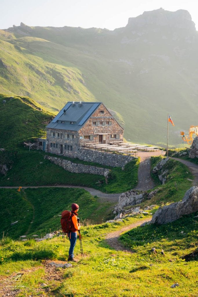
Gafadura Hütte is a popular day hiking and mountain biking destination. It’s an atmospheric hut with a fabulous team led by Silke and Thomas Tschiggfrei. We felt extremely welcome here.
Stage 1 Trail Stats
Starting Point | Planken Schulhaus Bus Stop
Ending Point | Gafadura Hütte
Distance | 4.4 km point-to-point
Time Needed | 2 hours
Elevation Gain | 636 meters
Elevation Loss | 0 meters
Difficulty | Easy
Learn More: Liechtenstein Panorama Trail Stage 1
Stage 2: Gafadura Hütte – Drei Schwestern – Fürstensteig – Berggasthaus Sücka – (Malbun)

From Gafadura Hütte, the trail rises through forest to the Sarojasattel (1628 m), which lies on the Austria-Liechtenstein border.
From the saddle, the trail ascends to the summit of Drei Schwestern (2053 m) and then continues to follow the ridge in a southerly direction to Kuegrat (2123 m), the highest point along the stage.
It’s possible to bypass the secured Drei-Schwestern-Steig by hiking to Garsella Alm.
From the Kuegrat peak, the trail descends easily across dwarf-pine-slopes to the Gafleisattel (1848 m), which marks the beginning of the Fürstensteig trail.
The Fürstensteig trail is a brittle mountain path carved into the rock. Though it looks menacing from afar, it’s heavily bolstered with timber reinforcements and secured with cables. So, it’s not difficult to hike.
When the Fürstensteig trail ends, route 66 continues with greater ease along a forest road and across meadows to reach Berggasthaus Sücka.
As stated earlier, we descended to Steg Tunnel bus stop and took bus 21 to Malbun, where we stayed the night in Hotel Turna Malbun.
Stage 2 Trail Stats
Starting Point | Gafadura Hütte
Ending Point | Berggasthof Sücka / Steg (bus to Malbun)
Distance | 12.9 km point-to-point
Time Needed | 5:50 hours
Elevation Gain | 893 meters
Elevation Loss | 1061 meters
Difficulty | Difficult
Learn More: Liechtenstein Panorama Trail Stage 2
Stage 3: (Malbun) – Berggasthaus Sücka – Chrüppel – Goldlochspitz – Rappenstein – Naaftal – Pfälzerhütte

We started the day with a rich and wonderful breakfast at Hotel Turna Malbun and then took bus 21 to Steg Tunnel bus stop.
We hiked back up to Berggasthaus Sücka in order to start the high-alpine route to Goldlochspitz (2110 m) and Rappenstein peak (2222 m). This high-altitude trail is a variation. If the weather is stable, we recommend it.
From Berggasthaus Sücka, the trail leads across pockets of forest and grazed mountain pastures along, or just below the main crest.
It’s very steep at times and physically demanding. We hiked through bushes of alpenrose, which were just beginning to bloom in late June, to Chrüppel (1707), marked with a private hut, bench, and cross.
The path continues to ascend along the forested mountain spine, eventually emerging above the tree line.
The treeless ridge path over Goldlochspitz is magic. The spine-tracing path drops down to Rappensteinsattel and then rises to Rappastein peak (slight detour), high above the Rhine Valley.
The trail returns to the saddle and descends to the Obersäss mountain pasture hut and then to the Undersässs mountain pasture hut.
Route 66 traverses verdant slopes, brimming with wildflowers, to reach the Valünerbach stream. After crossing the stream, the trail ascends Naaftal valley to Pfälzerhütte.
This attractive stone hut stands on the Bettlerjoch saddle between Augstenberg and Naafkopf.
Our stay at Pfälzerhütte was one of the highlights of the tour. We hope René Keel manages this hut FOREVER, because he’s extremely welcoming. We had a delightful time here and look forward to revisiting.
Stage 3 Trail Stats
Starting Point | Steg Tunnel Bus Stop
Ending Point | Pfälzerhütte
Distance | 14.1 km point-to-point
Time Needed | 6:50 hours
Elevation Gain | 1476 meters
Elevation Loss | 642 meters
Difficulty | Difficult
Learn More: Liechtenstein Panorama Trail Stage 3
Stage 4: Pfälzerhütte – Naafkopf – Pfälzerhütte – Augstenberg – Malbun

The last day begins with a sunrise, or early morning hike to Naafkopf peak (2 hours out-and-back). Naafkopf is located on the triple border between Switzerland, Austria, and Liechtenstein.
From Pfälzerhütte, Route 66 dramatically leads north along the ridge to Augstenberg peak (2359 m).
From the summit, the trail continues along the main crest to Sareiserjoch (2000 m) and then descends to Malbun.
Stay 1 night in Malbun, or continue your journey to Vaduz, or beyond.
Stage 4 Trail Stats
Starting Point | Pfälzerhütte
Ending Point | Malbun
Distance | 10.5 km
Time Needed | 4:45 hours
Elevation Gain | 718 meters
Elevation Loss | 1216 meters
Difficulty | Moderate
Learn More: Liechtenstein Panorama Trail Stage 4
When to Hike to Liechtenstein Panorama Trail

The best time to hike in Liechtenstein is between mid-June and late-September (or even mid-October), when the trail is snow-free and the huts are open.
We hiked the route at the end of June (during the week). We saw more wildflowers in 4 days than I have ever seen in my life.
As much as we love the clear skies of September, early summer is such a vibrant and colorful time of year to hike in the Alps.
Liechtenstein Panorama Trail Waymarking and Signage

The Liechtenstein Panorama Trail is waymarked and signed throughout. Follow trail 66.
Like in Switzerland and in Vorarlberg, Austria, moderate trails are marked with white-red-white painted waymarks and difficult alpine trails are marked with white-blue-white painted waymarks.
At the start of the Drei Schwestern Trail, we saw a “Blue” Alpine trail notice, with the following information:
- Particularly dangerous path with climbing points and glacial crossings.
- For use at your own risk.
- Mountaineering equipment is essential.
- Only for experienced hikers without vertigo.
- Keep an eye on the weather and length of the tour.
- Wet paths and terrain are dangerous. Pay attention.
Safety
Hiking in Liechtenstein is safe so long as you’re properly equipped (sturdy hiking boots, hiking poles, sun protection, sufficient water) and properly prepared.
Mountain Pastures: Grazing Cows & Calves

Like other places in the Alps, high-alpine meadows are grazed in summer. The Liechtenstein Panoramaweg crosses several such pastures.
It’s imperative to cross mountain pastures quickly and quietly. Give cows and calves a wide berth and never touch them, or disturb them in any way.
Cows are not aggressive animals, but they will protect their calves, if they perceive a threat.
The mountain pastures in Liechtenstein are fenced off and are often marked with a sign. Usually, you’ll enter a pasture via a turnstile, gate, or fence opening. Make sure to always close any gates after passing through.
Weather

We only recommend hiking this high-altitude trail in stable conditions.
It’s not safe to hike the ridge paths in the rain.
Drinking Water
During the hike, you’ll pass by a number of troughs. Some have potable water, while others do not. These troughs are usually signed. “Trinkwasser” means drinking water. “Kein Trinkwasser” means it’s not drinking water.
Final Thoughts: Pros and Cons

We absolutely loved this route, because there’s a lot of ridge hiking and varied scenery.
We relished the solitude. Apart from the Fürstin-Gina-Weg (stage 4), we rarely passed another hiking group.
Furthermore, the hospitality along the trail was outstanding. The hut managers were very friendly and convivial. And, the Hotel Turna Malbun staff were extremely accommodating and kind.
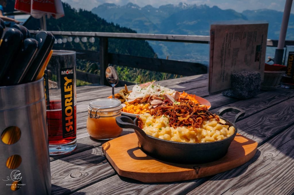
The only disadvantage of the Liechtenstein Panoramaweg is that there are no places to eat along the stages.
And, this is not a budget-friendly hike. Prices are comparable to those of Switzerland.

Liechtenstein Hiking Essentials
Hut Hiking Packing List
Read our complete hut-to-hut hiking packing list.
Mountain Hut Essentials
Pack these mountain hut essentials in addition to sufficient cash, your alpine club membership card, Kindle, sun protection, cosmetics, and ear plugs.
- Sleeping Bag Liner: Sea to Summit Silk-Cotton Blend Travel and Sleeping Bag Liner (what we use). Other options: Cocoon Cotton TravelSheet and Yen’s Mulberry Silk Sleeping Bag Liner
- Waterproof Slippers: Crocs. I also like bringing these Crocs Women’s Swiftwater Sandals, because they’re more versatile.
- Headlamp: Black Diamond Equipment Spot 350 Headlamp
- Plug Type J Adaptor: Liechtenstein uses plug type J (three round pins), like Switzerland. USA – Plug J outlet adaptor. We used this :EU to Plug J outlet Adaptor.
Hiking Gear
- Hut-to-Hut Hiking Backpack: Osprey Kyte 36 Women’s Hiking Backpack / Osprey Kestrel 48 Men’s Hiking Backpack
- Grade B/C high-cut hiking boots: Meindl Schuhe Island Lady (Kati’s Boots), Women’s Hanwag Tatra II GTX (Sabrina’s Boots), Men’s Hanwag Tatra II GTX (men’s equivalent)
- CAT 4 Sunglasses: Julbo Shield Mountain Sunglasses
- Hiking Poles: Black Diamond Trail Trekking Poles
- Reusable Water Bottle: Ion Leakproof 32 oz Water Bottle
Outdoor Photography Gear
- Camera Body: Sony Alpha a6400
- Mid-range Zoom Lens: Tamron 17-70mm 2.8 Di III-A VC RXD
- Wide angle Zoom Lens: Sony – E 10-18mm F4 OSS Wide-angle Zoom Lens
- Backpack Camera Clip: Peak Design Camera Clip
Learn more about the Alps
Essential Tips:
- The Alps in Summer: 10 Things You Need to Know Before Visiting
- Hiking in the Alps: Essential Tips
- Best Hikes in the Alps
Hut-to-Hut Hiking in the Alps:

Hello! Thank you so much for this information, it has been really helpful in planning my own hike! I have been having trouble figuring out whether the dorm beds in the mountain huts require reservations, or whether it is on a first come first serve basis each day. If reservations are necessary, how does one go about doing this? Any help would be very much appreciated! Thank you!
Reservations are absolutely necessary. You have to email, or call the hut to make a reservation.
All the best,
Sabrina