The 39-km-long Montafon Valley in Vorarlberg, Austria, is bounded by the Verwall, Silvretta, and Rätikon Mountain Ranges.
These three mountain ranges are linked together in one dramatic long-distance hiking trail known as the Montafoner Hüttenrunde (Montafon Hut to Hut Circuit).
After completing 5 stages of the 13-stage Montafon Hut to Hut Circuit, we were blown away by the scenery, the quality of the mountain huts, and the overall charm of the region. Along this enchanting hiking trail, water, snow, and ice are constant companions as are soaring 3000+ meter peaks that sharply pierce the sky.
Every day during our trek, I said to Kati: “Can we PLEASE move here?!?!… I want to move here… When are we moving here??… I’m a Vorarlbergerin at heart!!!”
This U-shaped Montafon hiking trail starts in Schruns and ends in Latschau (very close to Schruns). Though we set out to do the first 8 stages, we couldn’t start until Stage 4, because of the weather. In the end, we were really satisfied with our hike, despite missing out on the first few stages.
In this Montafon trekking guide, we’re outlining our 5-stage trek (4-5 days), which starts at Silvretta Bielerhöhe (accessible by bus from Schruns) and ends in Latschau/Schruns.
We wrote this detailed Montafon Circuit Trail trekking guide based on our personal experience. Keep in mind that things can change over time: trail difficulty, accessibility, and routing (due to rock falls, landslides, and avalanches) and hut management (reservation system, hospitality, payment, food quality, etc…). Please do your due diligence before tackling this route.
- When to Hike: July, August, or September
- Where to Stay: Mountain Huts only. Camping is strictly prohibited.
- How to Book the Montafon Trek: Independently. Instructions below. If you want to book a self-guided trek, check out these alternative trails: 6-Day Hut to Hut Light in the Austrian Alps (kid-friendly), 8 Day Culinary Delight Hut Hiking Tour, and 3 Day Culinary Delight Extended Weekend Hiking.
- Overnight Hut Discounts: Discounts are administered to guests with Alpine Club ID cards on which the logo of the reciprocal rights agreement is printed. Learn more about alpine club membership in Tips for Hiking in the Alps.
- What to Pack: Cash, sleeping bag liner (e.g. Sea to Summit liner). Read our Hut to Hut Hiking Packing List.
- Trail Map: Montafon WK 374
- Tips for Hut Hiking in Austria: Read our guide to Hut to Hut Hiking in Austria: Essential Tips and Visiting Austrian Mountain Huts
- Where to Stay Before/After the Trek: TUI Blue Montafon (budget), Gasthof Löwen (midrange), or Amrai Suites (luxury) in Schruns-Tschagguns
Montafon Hut Circuit Trail Map
MONTAFON TREK STAGES
Where to Stay Before/After the Trek
Day 1 (Stage 4)
Day 2 (Stage 5)
Day 3 (Stages 6-7)
Day 4 (Stage 8)
Exit Route to Schruns
Other Stages
Montafon Hut Circuit Trail Itinerary
Montafon Hut to Hut Circuit: Official Route
Stage 1 | (Schruns) – Slibertal – Wormser Hütte (4:15 hours, 8.6 km)
Stage 2 | Wormser Hütte – Neue Heilbronner Hütte (8:30 hours, 22 km)
Stage 3 | Neue Heilbronner Hütte – Silvretta Bielerhöhe (8:15 hours, 18.3 km)
Stage 4 | Silvretta Bielerhöhe – Wiesbadener Hütte (3:30 hours, 8.3 km)
Stage 5 | Wiesbadener Hütte – Saarbrücker Hütte (4:45 hours, 10.7 km)
Stage 6 | Saarbrücker Hütte – Tübinger Hütte (2:45 hours, 4.6 km)
Stage 7 | Tübinger Hütte – Gargellen (5 hours, 12.2 km)
Stage 8 | Gargellen – Tilisunahütte (4:45 hours, 9.9 km)
Stage 9 | Tilisunahütte – Lindauer Hütte (2:30 hours, 4.6 km)
Stage 10 | Lindauer Hütte – Totalphütte (4:45 hours, 10.6 km)
Stage 11 | Totalphütte – Douglass Hütte (1:11 hours, 3 km)
Stage 12 | Douglass Hütte – Heinrich Hueter Hütte (2 hours, 4.8 km)
Stage 13 | Heinrich Hueter Hütte – Latschau (5:15 hours, 13.5 km)
The final stages of the Montafon Hut Circuit official trail are very short, because they didn’t want to cut out any of the mountain huts. It’s a normal Austrian solution; it doesn’t make sense, but no one is offended. Our recommendation is to combine several stages. For example, you could combine stage 6 and 7, stages 9 and 10, and stages 11 and 12.
Montafon Hut to Hut Circuit: Our Route
Day 1 (Stage 4) | Schruns – Bus to Silvretta Bielerhöhe – Wiesbadener Hütte (3:30 hours, 8.3 km)
Day 2 (Stage 5) | Wiesbadener Hütte – Saarbrücker Hütte (4:45 hours, 10.7 km)
Day 3 (Stages 6 and 7) | Saarbrücker Hütte – Tübinger Hütte – Gargellen (7:45 hours, 16.8 km)
Day 4 (Stage 8 and Exit Route) | Gargellen – Tilisunahütte – Tobelsee – Latschau – Schruns (9 hours, 21.9 km)
We started our Montafon hut to hut trek at Silvretta Bielerhöhe, the beginning of Stage 4, because we had to skip the first 3 stages due to poor weather. While we were sad to miss the Verwall section of the trek, we were delighted by the Silvretta stages.
On Day 3, we combined two stages. It was a long day, but doable.
On Day 4, we completed stage 8 of the trek and then continued all the way down to Schruns in Montafon Valley. In retrospect, it would have been better to stay the night in Tilisunahütte (or even Lindauer Hütte) and then exit the trail the next day. Our final day was simply too long.
The reason we didn’t continue hiking along the Montafon Hut Circuit Trail was because we had already hiked stages 9 through 11 along the Rätikon High Trail Circuit the year before. These stages are gorgeous. So, please don’t miss them.
After staying the night in Tilisunahütte, definitely continue the trek to Lünersee. You can stay at the lakeside Douglass Hütte, or continue to Totalphütte.

Montafon Hut Circuit Trail Difficulty
Based on our experience of hiking stages 4 through 11, we’d classify this hike as “moderately difficult” with some very easy sections as well as some very challenging sections.
Expect some very steep passages along this route.
We hiked the route in mid-July and there were still many snowfields in the Silvretta Mountains. These snowfields were tricky to cross in the morning (still frozen).
For more information about trail difficulty, please reach out to the Montafon tourist office.
How to Book the Montafon Hut Circuit Trail
All mountain huts along the Montafon Hut Circuit must be booked individually and independently.
It’s important to make reservations for overnight stays in huts several months in advance. You may be able to book more short-term, if you have a flexible start date.
You can make overnight reservations for most huts along the Montafon High Trail using the Alpsonline online reservation platform.
For more information about booking huts, read our guide to visiting Austrian Mountain Huts. For information about pricing, hut etiquette, joining the Austrian Alpine Club, helpful German phrases to know for hiking in Austria, read hut to hut hiking in Austria.
Arrival Day | Stay in Schruns-Tschagguns at TUI Blue Montafon (budget), Gasthof Löwen (midrange), or Amrai Suites (luxury).
Stage 1 | Wiesbadner Hütte – Online Reservation via Alpsonline
Stage 2 | Saarbrücker Hütte – Online Reservation via Alpsonline
Stage 3 | Tübinger Hütte – Online Reservation via Alpsonline
Stage 4 | Tilisuna Hütte – Online Reservation via Alpsonline
Stage 5 | The trek ends in Latschau / Schruns-Tschagguns. We recommend staying in Schruns-Tschagguns after the trek: TUI Blue Montafon (budget), Gasthof Löwen (midrange), or Amrai Suites (luxury).

Arrival Day in Schruns in Montafon Valley
How To Get to Schruns
For regional travelers, we recommend traveling by train to Bludenz in Vorarlberg. From Bludenz, take a regional trail to Schruns (20 minutes).
The closest international Airport to Montafon Valley is Zurich-Kloten (ZRH) in Switzerland. Another option is to fly to Munich (MUC) in Germany. If you’re traveling from the UK, you could also fly into Memmingen Airport (FMM) in Germany.
Zurich – Schruns | 2 hours by car / 2:30 hours by train
Munich – Schruns | 2:30 hours by car / 5 hours by train
Memmingen – Schruns | 1:30 hours by car
Where to Stay in Schruns-Tschagguns


Budget | The brand new TUI Blue Montafon hotel in Tschagguns features modern, comfortable, and quiet (sound-proof) bedrooms. Guests praise the attentiveness and friendliness of the staff. And, the breakfast buffet is excellent, offering a lot of variety and local ingredients. The hotel has an on-site restaurant (limited menu) and small spa area.
Midrange | The quaint Gasthof Löwen in Tschagguns is a traditional, family-run hotel dating back to 1500. The hotel restaurant is one of the best places to eat in Montafon. It’s also one of our favorite restaurants in all of Austria. Expect a wonderful breakfast as well. On Thursdays, the family members play traditional music in the bar. Guests also have access to the Montafoner Hof indoor-outdoor pool.
Luxury | Amrai Suites is a brand new alpine-modern hotel in Schruns with an on-site restaurant, and luxurious wellness area. Tastefully designed with natural materials and an earthy color palette, the hotel bedrooms are both incredibly calming and visually stunning. Highlights of staying here are the breakfast buffet, creative dinner menus (featuring local and fresh ingredients), and the Stólla spa oasis.
Where we stayed | Löwen Hotel Montafon is a 4-star superior hotel in Schruns with a massive 3000 m2 wellness and spa area. The spa contains an indoor and outdoor pool, five saunas, a Lady’s spa area, a whirlpool, multiple relaxation rooms, waterbeds, a refreshment bar, and a reading room. The hotel’s bold interior design honors the Montafon Valley with its use of local materials and regional motifs. You’ll see this keenly expressed in the hotel’s impressive lounge, bar, and lobby area. Skip dinner here and eat in town at Gasthof Löwen.
Look for accommodation in Schruns-Tschagguns.

Montafon Trek Day 1 (Stage 4): Silvretta Bielerhöhe – Wiesbadener Hütte
This stage is on the short side. For those that hiked Stage 2 (22 km) & Stage 3 (18.3 km), Stage 4 is a well-earned and very needed respite.
For those starting their trek here (like us), Stage 4 is rather easy and short. To make it longer and more challenging, you can summit Hohes Rad (2934 m) today as well.
Stage 4 Trail Stats
Distance | 8.3 km
Time Needed | 3:30 hours
Elevation Gain | 706 meters
Elevation Loss | 295 meters
Difficulty | Easy
Minimum Elevation | 2025 meters
Maximum Elevation | 2660 meters
Route | Silvretta Bielerhöhe (2037 m) – Radsattel (2652 m) – (Hohes Rad, 2934 m) – Wiesbadener Hütte (2443 m)
Lunch Option | There are places to eat at the trailhead.
How to Get to the Silvretta Bielerhöhe Trailhead
Stage 4 of the Montafon Hut-to-Hut Circuit begins at Silvretta Bielerhöhe (2037 m), which is a mountain pass that connects Vorarlberg’s Montafon Valley with the Paznaun Valley in Tyrol.
Silvretta Bielerhöhe is also located along the Silvretta High Alpine Road between the Verwall mountain range and the Silvretta Alps. Here, there’s an impressive reservoir, a tourist shop and restaurant, a hotel, and a mountain hut.
Silvretta Bielerhöhe is accessible by bus from Schruns. Simply head to the Schruns Bahnhof and take Bus 650 (cash only) to Silvretta Bielerhöhe. The bus ride is 1 hour.
Silvretta Bielerhöhe to Radsattel (2:40 hours)
From the bus stop at Silvretta Bielerhöhe (2037 m), head in the direction of Tirol, passing the tourist shop and the restaurant. Hike along the Silvretta Staumauer (reservoir wall), hugging the reservoir, and make your way to Bieltal (Biel Valley).
Follow signs to Wiesbadener Hütte. When the trail divides, follow the left trail to Wiesbadender Hütte über Bieltal (3:15 hours) and Radsattel (2:15 hours).
There are other ways to Wiesbadener Hütte, but this is the most beautiful. As you continue, there are spectacular views of the serpentine Silvretta High Alpine Road (Silvretta Hochalpenstrasse) on your left.
The trail gently ascends along the Bieltalbach (Biel Valley Stream) all the way to Radsattel (2652 m, Rad Saddle). Accompanied by the sound of running water, you’ll follow this soft valley trail for a good 1:30 hours before it steepens.
As you near the saddle, you’ll traverse some boulders and possibly a snowfield (in early summer). There’s a small lake on your right called Radsee. Keep your eyes out for roaming Ibex. We saw at least two dozen.
The Radsattel (2652 m) is the mountain saddle between Bieltalkopf (2797 m, Biel Valley Head) and Hohes Rad (2934 m). When you crest the saddle, you won’t believe your eyes.
With its razor-sharp peaks and glacial ice, the imposing Silvretta range seems to puncture the sky.
From Radsattel, it’s a mere 50-minute hike to Wiesbadener Hütte (2443 m).
Optional Detour: Hohes Rad Peak (2:30 hours out-and-back)
For those that want to detour to Hohes Rad peak, you can turn right at the Rad saddle and hike 30 minutes to the Radschulter (Rad Shoulder), crossing a slope of boulders and snow.
From the Radschulter (2697 m), it’s a 40-minute ascent to the peak. This trail requires some scrambling, sure-footedness, and a head for heights.
We recommend leaving your heavy backpacks at the Radschulter, before ascending. The peak rewards you with panoramic views of the Silvretta range. Return by the same route to the Radsattel.
- Distance: 3.1 km out-and-back
- Time Needed: 2:30 hours
- Elevation Gain/Loss: 373 meters
- Difficulty: Difficult
- Minimum Elevation: 2618 meters
- Maximum Elevation: 2934 meters
Radsattel to Wiesbadener Hütte (50 minutes)
From the Radsattel, descend in the direction of the small tarn straight ahead. Before reaching the tarn, the trail splits. Follow the left trail to Wiesbadener Hütte (40 minutes).
From the tarn, the trail ascends again gently and you’ll follow an undulating path for the next 30 minutes.
The scenery stretches out sublimely before you, creating a visual crescendo of soaring peaks, accented by glacial ice. It feels like you’re embarking on an epic journey with great purpose and a sense of adventure.
Ultimately, you’ll descend to Wiesbadener Hütte (2443 m), the impressive mountain lodge facing Piz Buin, the Ochsentaler glacier, and the Silvrettahorn.
Stay in Wiesbadener Hütte

Wiesbadener Hütte (2443 m) is a large mountain hut that serves as the base for glacier and climbing tours to Piz Buin and surrounding peaks.
When you arrive, the adrenalin is almost palpable. On the weekend, the hut is buzzing with group tours and independent climbers. It’s quite something.
We were really impressed by the management of this hut. The staff is attentive, fast, and friendly, despite the number of people. They’ve got it down!
Reservation | Online-Reservation via Alpsonline
Payment | Cash Only
Showers | 1 EUR for 1:30 Minutes, operated by 1 EUR coins.
Drinking Water | Tap water is safe to drink.
Electronic Charging Stations | In rooms, or in the hallways.
Food | Very good
Half Board or à la carte | Both available
Rooms | Dormitory, and private rooms

Montafon Trek Day 2 (Stage 5): Wiesbadener Hütte – Saarbrücker Hütte
Stage 5 Trail Stats
Distance | 10.7 km
Time Needed | 4:45 hours
Elevation Gain | 801 meters
Elevation Loss | 704 meters
Difficulty | The first half is easy, the second half is difficult
Minimum Elevation | 2037 meters
Maximum Elevation | 2737 meters
Route | Wiesbadener Hütte (2443 m) – Ochsental – Silvrettasee – Klostertal – Verhupftäli – Litzner Sattel (2740 m) – Saarbrücker Hütte (2538 m)
Lunch Option | None
Wiesbadener Hütte to Saarbrücker Hütte (4:45 hours)
The beginning of Stage 5 of the Montafon Hut to Hut Circuit is blissfully easy. You’ll hike down Ochsental Valley to the Silvretta Stausee. Behind you, Piz Buin glows in warm tones of orange and choral.
When the Ochsental trail intersects the Silvretta Stausee circuit trail, turn left. Following the reservoir circuit trail, you’ll cross a bridge, and then you’ll soon turn left in the direction of Saarbrücker Hütte (signed 3:15 hours).
A flat, level trail follows the Klostertaler Bach stream up Klostertal Valley. After about 700 meters, there’s an opportunity to cross the stream and follow the hiking path on the right-side of Klostertaler Bach.
We didn’t cross here, because we wanted to stay on the easy-wide track on the left side. However, this is the “easier” way to cross the stream.
If you stay on the left-side (like we did), you’ll have to cross the Klostertaler Bach stream further up the valley via two narrow footbridges.
Kati had no problem crossing these footbridges. I hated them (they made me dizzy), and avoided the second one altogether, crossing a different way entirely.
After you cross the stream (where the two footbridges are), you’ll start ascending rather quickly and steeply to Litznersattel. It’s a calf burner.
As you ascend, the views behind you crescendo with every meter gained. Klostertaler Egghorn (3120 m), Schattenkopf (3114 m), Schattenspitze (3202 m), Schneeglocke (3223 m), and Knoten (3190 m) rise up magnificently, creating a nightmarish ensemble of pitch-black peaks.
When the trail plateaus, you’ll hike along level ground for a few meters, before once again ascending through a rocky landscape. It looks like you have to traverse boulders, but the path is cut very well, making this part actually easier than you’d expect.
When you crest (unfortunately not the saddle), you’ll see a tiny tarn below. Descend to the small tarn and then ascend one last time to Litznersattel.
From the Litznersattel (2740 m), it’s 50-minutes to Saarbrücker Hütte (2538 m). The hut is already visible from the saddle. The descent is slippery at first but becomes increasingly easier.
We crossed several snowfields before reaching the “valley” floor. The trail intersects a road, which you can follow all the way to the hut (20 minutes). There’s also a hiking path, which is a bit faster.
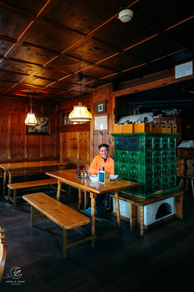
Stay in Saarbrücker Hütte

Saarbrücker Hütte (2538 m) is an effortlessly charming, laid-back mountain hut facing Grosslitzner (3109 m) and Grosses Seehorn (3121 m).
Whether you enjoy the late afternoon sun on the outdoor terrace or take shelter in the interior dining room, this perfect mountain hut will remind you why you love hiking in the Austrian Alps (if you need a reminder that is).
You can expect excellent food served with kind smiles.
Reservation | Online reservation via Alpsonline
Payment | Cash only
Showers | 3 EUR for a 4-minute, token-operated shower
Drinking Water | Tap water is safe to drink
Electronic Charging Stations | Hallway, or in the dining room (near the server window)
Food | EXCELLENT!!!!
Half Board or à la carte | Both available
Rooms | Dormitory, and private rooms

Montafon Trek Day 3 (Stages 6 & 7): Saarbrücker Hütte – Gargellen
Stage 6 Trail Stats
Distance | 4.6 km
Time Needed | 2:45 hours
Elevation Gain | 398 meters
Elevation Loss | 746 meters
Difficulty | Difficult
Minimum Elevation | 2190 meters
Maximum Elevation | 2774 meters
Route | Saarbrücker Hütte (2538 m, Gletscherfreier Weg) – Seelücke – towards Schottensee (CH) – Plattenjoch – Tübinger Hütte (2191 m)
Lunch Option | Tübinger Hütte
Saarbrücker Hütte to Tübinger Hütte (2:45 hours)
Stage 6 begins with a 50-minute ascent to Seelücke (“lake gap”). At Seelücke, you’ll descend into Switzerland, in the direction of Schottensee (lake).
You’ll hike one-hour on the Swiss-side to Seetal and up to Plattenjoch. Initially, the descent is bolstered by wooden beams. Take extra care here, as the terrain isn’t stable.
Surrounded by rocky slopes and mountains, It feels very desolate and lonesome on this side. After about 30-minutes, you’ll turn right in the direction of Plattenjoch (Platten pass). There are some steel chains to aid your ascent.
From Plattenjoch, cross back into Austria and descend 1:30 hours (520 m) to Tübinger Hütte. At first, the trail was quite slippery and steep.
In mid-July, 70% of the route to Tübinger was covered in snow. Hiking poles are essential. As you near the hut, the trail is lined with alpenrose.
Stage 6 ends at Tübinger Hütte (2191 m). Most hikers will stay overnight here. We decided to eat lunch at the hut and continue hiking to Gargellen.
Combining stages 6 and 7 is doable if you’re conditionally fit and are comfortable hiking 16.8 km in a single day.
Stage 7 Trail Stats
Distance | 12.5 km
Time Needed | 5 hours
Elevation Gain | 343 meters
Elevation Loss | 1109 meters
Difficulty | Moderate
Minimum Elevation | 1406 meters
Maximum Elevation | 2513 meters
Route | Tübinger Hütte (2191 m) – Mittelbergjöchli – Vergaldner Jöchli – Vergadnertal – Alpe Vergalden (1820 m) – Gargellen (1423 m)
Lunch Option | Alpe Vergalden
Tübinger Hütte to Gargellen (5 hours)
From Tübinger Hütte (2191 m), you’ll backtrack a few meters and turn right, following signs to Vergaldner Joch (1:45 min) and Gargellen (5 hours). Slabs of stone guide you across the Garnerabach stream.
For the next hour, you’ll horizontally cross the mountain slopes on the opposite side of Garneratal Valley (across Tübinger Hütte). The path traverses alternating slopes of boulders and grass, before making an ascent to Mittelbergjöchli (pass).
Glancing back at the hut and the mountain wall rising above, you’ll be extremely impressed and possibly bewildered about your descent from Plattenjoch. HOW ON EARTH DID WE COME DOWN THAT?!?!?
At Mittelbergjöchli, you’ll descend and then make a counter-ascent to the Vergaldner Jöchli pass. It’s only 780 meters between the two Joche (passes).
Vergaldner Jöchli begs you to take off your backpack, rest, and enjoy the views. It’s only downhill from here! Also, you can already see the limestone peaks of the Rätikon.
From Vergaldner Joch, it’s 2 hours to Alpe Vergalden and 3:15 hours to Gargellen. The descent is nice and easy.
You’ll cross grassy slopes brimming with wildflowers: royal blue Enzian, violet Fairy’s Thimble, baby-blue Forget-me-not flowers, pink Alpen Rose, and yellow Buttercup.
At Rotbühel, you’ll turn right and follow the Vergalda Tal valley trail that runs parallel to the Vergaldenbach stream. More easy walking, yay!!
The trail eventually crosses the Alpe Vergalden (1820 m), which is an active alpine dairy farm surrounded by grazing mountain pastures. You’ll hear the bells before you see the Alpe.
Note: in Vorarlberg, Alpe means alpine pasture. In Salzburg and Styria, mountain pastures are called Almen (singular: Alm).
Alpe Vergalden is an enchanting place to rest, try homemade Muntafuner Sura Kees, and enjoy the alpine setting. If you walk into the hut, you can see their cheese production in process.
We loved it here. It’s one of those places that make your heart fuller.
After a well-deserved and restorative break at the Alpe, continue walking down the valley along the road. After about 35 minutes, the road divides.
Take the right path, which slopes down, and turn right at the intersection (Gargellen is signed 25 minutes). You’ll cross a bridge and walk through the forest, before arriving in Gargellen village (1423 m).
Stay in Gargellen
Gargellen (1423 m) is a mountain village in Montafon Valley. After a few nights in mountain huts, it’s a treat to stay in a hotel.
Budget | Pension Edelweiss
Midrange | We stayed at Hotel Alpenrose, located directly on the Montafon Hut Circuit Trail. We ate a delicious half board dinner at the hotel. Their salad buffet is especially plentiful and scrumptious. Before dinner, we were able to enjoy the hotel’s wellness area, which comprises a Finnish sauna, a steam sauna, an infrared sauna, and a resting room. After our 16 km hike, this was a BLESSING!
Luxury | Sporthotel Bachmann
Look for accommodation in Gargellen.

Montafon Trek Day 4 (Stage 8): Gargellen – Tilisunahütte
Stage 8 Trail Stats
Distance | 9.6 km
Time Needed | 4:45 hours
Elevation Gain | 1068 meters
Elevation Loss | 284 meters
Difficulty | Moderate
Minimum Elevation | 1425 meters
Maximum Elevation | 2395 meters
Route | Gargellen (1423 m) – Untere Röbialpe – Obere Röbialpe – Sarottlajoch – Plasseggenpass (2354 m) – Grubenpass – Tilisunahütte (2211 m)
Lunch Option | Ronggalpe (at the very beginning of the stage) and Tilisunahütte (final destination)
Gargellen to Sarottlajoch (3 hours)
From Hotel Alpenrose, follow the trail in the direction of Ronggalpe. Cross the meadow. As you ascend, the views of Gargellen are delightful.
After about 25-30 minutes, you’ll arrive at Ronggalpe, an idyllic alpine pasture surrounded by donkeys, pigs, and horses.
Just before the Alpe, a trail bears right, sloping downwards, in the direction of Sarottlajoch (3 hours) and Tilisuna Hütte (4:15 hours). After crossing the Röbibach stream, you’ll hike through the forest and then up another alpine pasture.
The ascent continues up sloping alpine pastures and forest. When you reach Obere Röbialpe (Upper Röbi Alpine Pasture), marked by a single wooden herdsmen hut, a Cross, and a bench, the trail levels out.
From the hut, head right and traverse the alpine pasture.
When you wrap around the slope and “turn a corner,” you’ll continue along an ever-so-slightly ascending trail to Sarottlajoch. The trail is washed out in some areas, so be mindful of where you step.
Sarottlajoch to Tilisunahütte (1:45 hours)
From Sarottlajoch pass (Swiss-Austrian Border), hike 20 minutes on the Swiss side to Plasseggenpass (Swiss-Austrian Border). The limestone Rätikon stands before you, an exciting contrast to the crystalline Silvretta mountains.
From Plasseggenpass (2354 m), the trail continues between the Rätikon and Silvretta ranges, traversing soft loamy terrain, to Grubenpass.
From Grubenpass, it’s a 30-minute walk to Tilisunahütte. You’ll pass a number of small tarns ringed with cotton flowers.
Tilisunahütte (2211 m) is spectacularly positioned high above Tilisuna Lake.
Stay in Tilisunahütte

After coffee and cake at Tilisunahütte (2211 m), we carried on to Tobelsee and all the way down to Montafon Valley. We’ll describe this exit route in the next section.
With breaks, it took us 11 hours (5:50 am – 5 pm) to hike from Gargellen to Schruns. If we could do it again, we’d stay the night in Tilisunahütte, or even in Lindauer Hütte, before hiking down to Schruns.
Reservation | Online Reservation via Alpsonline
Payment | Cash, or Credit Card
Showers | 1 EUR for 1 Minute
Drinking Water | Tap water is safe to drink
Electronic Charging Stations | Available
Food | Very good
Rooms | Rooms with 5-7 beds. Dormitory with 10-13 beds.

Montafon Trek Day 5 Exit Route: Tilisunahütte – Latschau
Exit Route Trail Stats
Distance | 8 km
Time Needed | 4 hours
Elevation Gain | 85 meters
Elevation Loss | 1302 meters
Difficulty | Moderate
Minimum Elevation | 993 meters
Maximum Elevation | 2209 meters
Route | Tilisunahütte (2211 m) – Schwarzhorn-Sattel (2171 m) – Tobelsee – Alpilaalpe (1680 m) – Gauer Tal – Latschau (993 m)
Lunch Option | You can eat a light snack at Alpilaalpe.
Tilisunahütte to Latschau (4 hours)
Stage 9 of the Montafon Hüttenrunde continues to Lindauer Hütte. We highly recommend that you continue your trek to Lindauer Hütte and onwards to Lünersee.
We hiked this route the previous year when we did the Rätikon High Trail Circuit, so we wanted to hike something new.
From Tilisunahütte, we continued to Tobelsee via Schwarzhorn-Sattel (2171 m). With Tilisuna lake on your right, you’ll descend to a grazing pasture dotted with cows.
Before crossing the second pasture fence, there’s a trail intersection. Turn left and hike up to Schwarzhorn-Sattel.
From the saddle, it’s a 20-minute descent to Tobelsee Lake. This tiny alpine lake serves up one of the best views of Drei Türme (Three Towers), a triad of Rätikon peaks.
We spent a good hour here, enjoying the view and cooling off our feet in the crisp lake water.
From the lake, you’ll descend to Alpilaalpe (45 minutes). The trail is easy and the views of the Rätikon are outstanding. On your left, you can see Lindauer Hütte at the foot of the Drei Türme. On your right, you’ll see Montafon Valley.
From Alpilaalpe (1680 m), follow the road until the hiking trail resumes. You’ll continue descending across a mountain slope to Gauer Tal Valley. Join the wide track (“Gauertalweg”) leading to Latschau.
From Latschau, you can take a bus to Tschagguns, or Schruns.
Note | It’s possible to hike to Schruns (4.3 km / 1:15 hours), but we recommend taking the bus. We hiked down to Tschagguns via the Schluchtweg (“gorge path”), which runs parallel to the Rasafei stream. Right before Hotel Montabella in Latschau, the Schluchtweg trail bears right. Follow this trail into Tschagguns. From Tschagguns, cross the river and walk 1.4 km to Schruns.
Stay in Schruns-Tschagguns
Budget | TUI Blue Montafon
Midrange | Gasthof Löwen
Luxury | Amrai Suites
Where we stayed | Löwen Hotel Montafon
Look for accommodation in Schruns-Tschagguns.

Vorarlberg Hiking and Travel Guides
More Hut to Hut Hiking Trails
Austria:
- Best Treks in Austria
- Emperor’s Crown (Kaiserkrone) Trek
- Rätikon High Trail
- Karwendel High Trail
- Eagle Walk
- Berlin High Trail
- Schladminger Tauern High Trail
- Venediger High Trail
Slovenia:
- Hut to Hut Hiking in Slovenia
- Mountain Huts in Slovenia
- Triglav National Park Hut to Hut Hike, Slovenia
- Kamnik Alps Hut to Hut Hike, Slovenia
Italy:
- Hut to Hut Hiking in the Italian Dolomites
- Alta Via 1 Trek, Italian Dolomites
- Tour du Mont Blanc Trek: France, Italy and Switzerland
- Ortler High Trail, Italy
Europe:

Pin this Image for Future Trip Planning!
Stay Connected:
Connect with us on Pinterest.
Follow us on Instagram.
Like us on Facebook.
Support Us:
If you love reading our content, you can buy us a coffee via Ko-Fi.
